

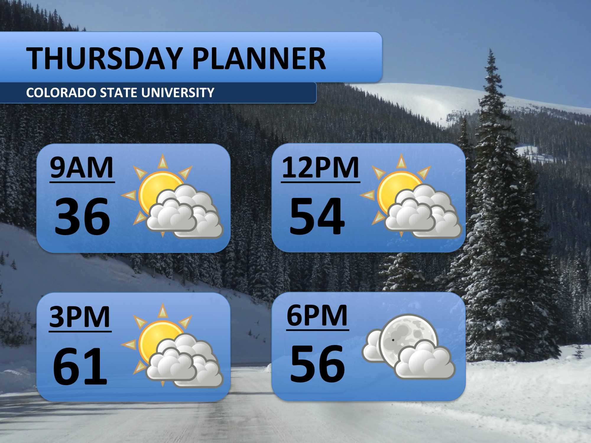
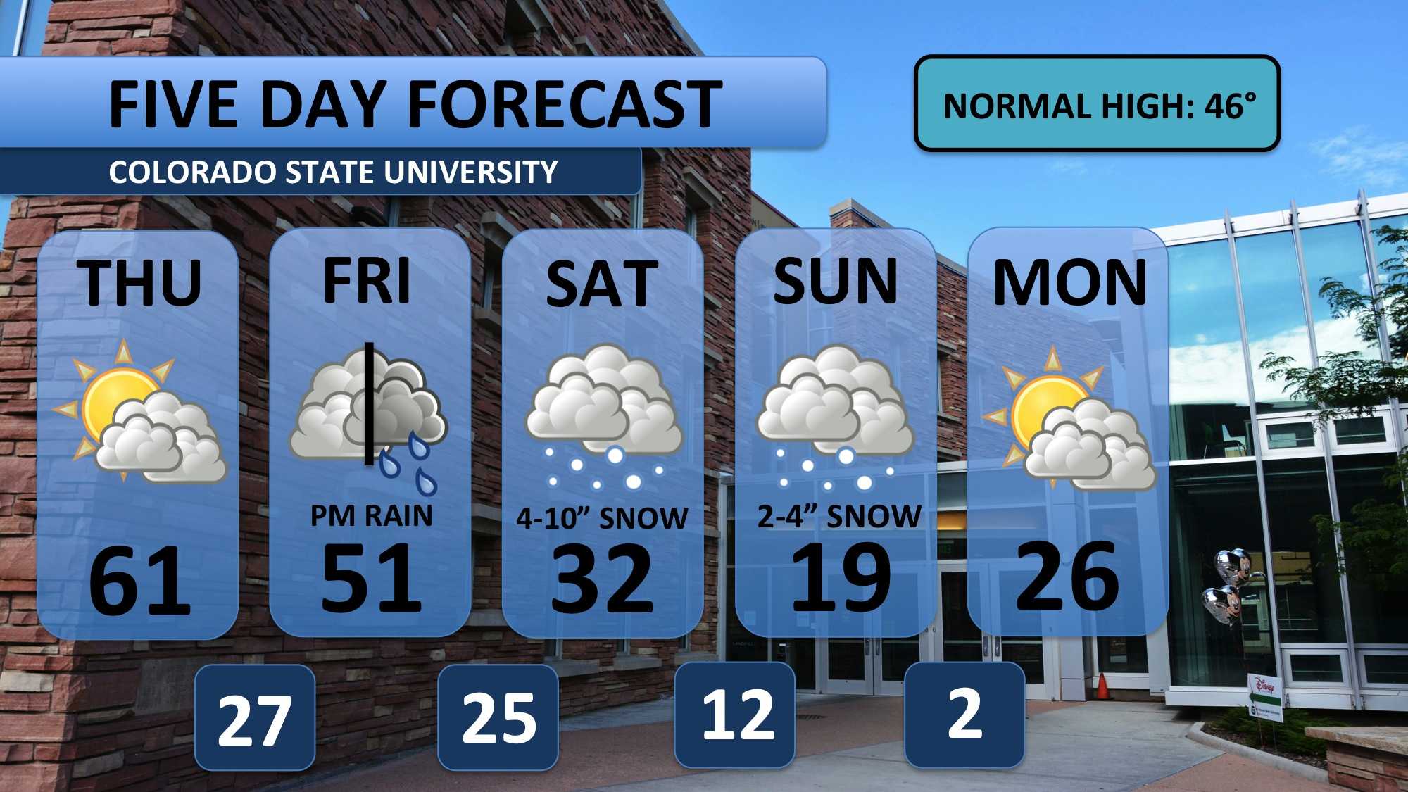
Thursday will be another mild day across the region. Highs will climb into the lower 60s, and skies will be partly cloudy. After the long period of spring-like weather we’ve been having, it’s easy to be lulled into a sense of comfort. Don’t be fooled — winter is still here!
Temperatures will still be somewhat seasonal on Friday, but there will certainly be more clouds. Rain is forecast to fall sometime during the afternoon or evening. Depending on the timing, it could certainly ice up the roads. We’ll have more on that tomorrow.
All attention is on the weekend as a winter storm is forecast to affect the urban corridor. Weather modeling has been all over the place all week. It continues to be non-specific today, but we have been able to develop a broader snowfall forecast (6-12 inches total). The core of the snowfall action is currently pegged for Saturday night and early Sunday, but snow should fall steadily for most of the weekend.
It’s also going to get pretty cold on Sunday and Monday so be prepared for that! Take a look at that low temperature for Monday morning — brutal. Check back tomorrow for an update on what we’re expecting this weekend!
Meteorologist Austin Harley can be reached on Twitter: @wx_harley.


