

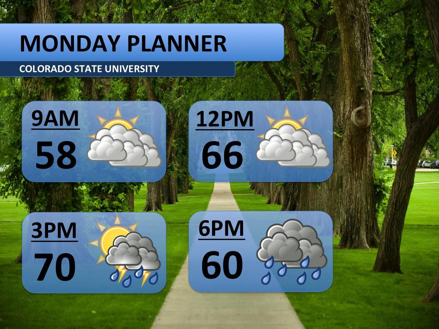
After last week’s heat wave, cooler fall temperatures have finally begun to settle in to Northern Colorado. The summer is not completely gone though. In Monday’s hour-by-hour planner, storms are forecast for the afternoon. A strong upper-level low pressure system will slowly pass over the area beginning Monday afternoon. If you plan on being out any time from 3:00 p.m. to midnight, bring an umbrella and a jacket. The main threats appear to be heavy rain and high winds; hail cannot be ruled out though.
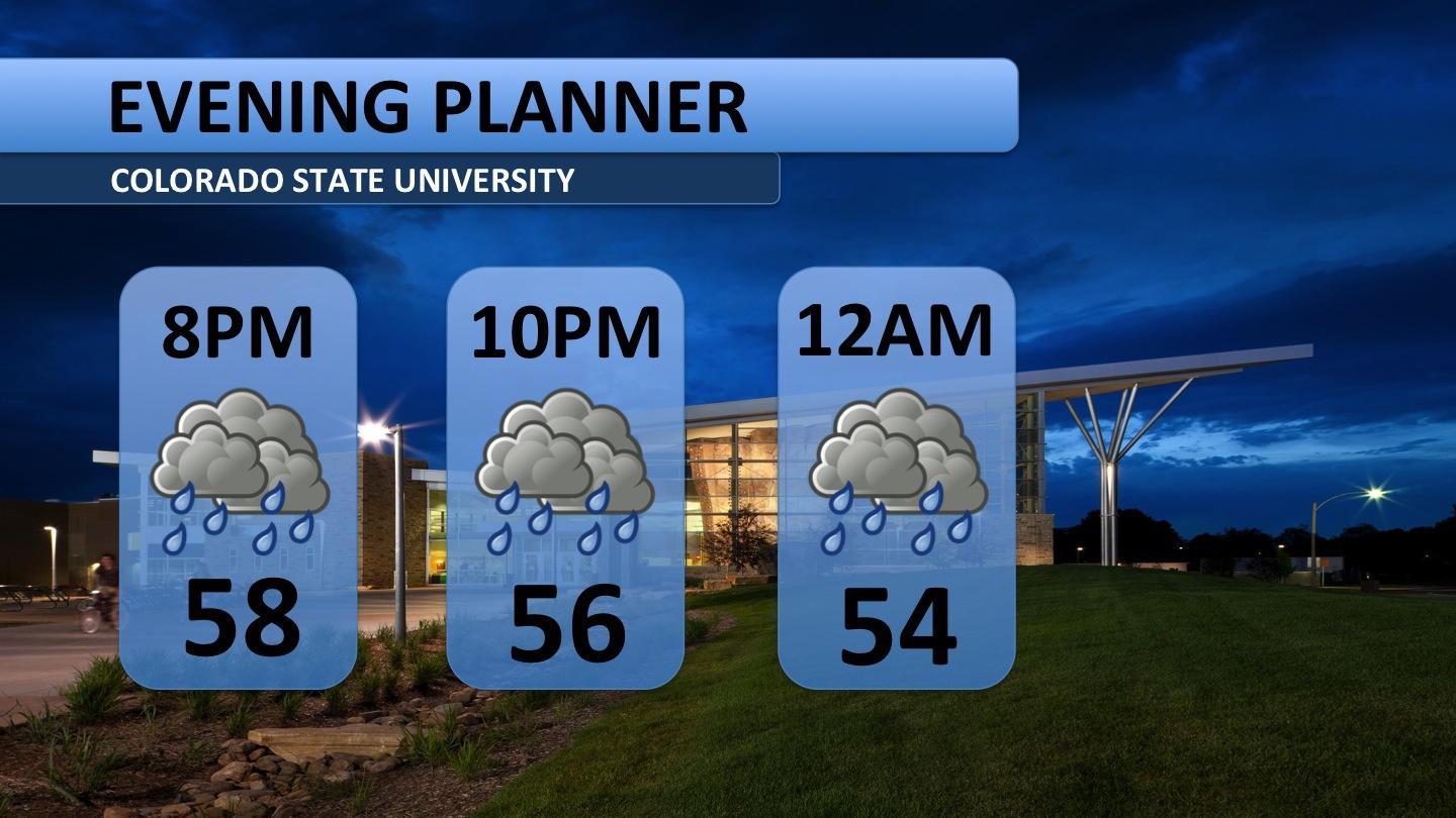
After sunset the storms will lose the heat they need to remain strong, so expect weaker showers through about midnight. It will be pretty chilly as well, 50s for most of the night. Bring a jacket.
Storms on Monday will strengthen as they move east of Fort Collins – larger hail, damaging winds, and tornadoes are all possible. I will be keeping a watchful eye on that throughout the afternoon and evening. Storms out east could also produce up to an inch of rain, whereas about a half an inch at CSU looks reasonable.
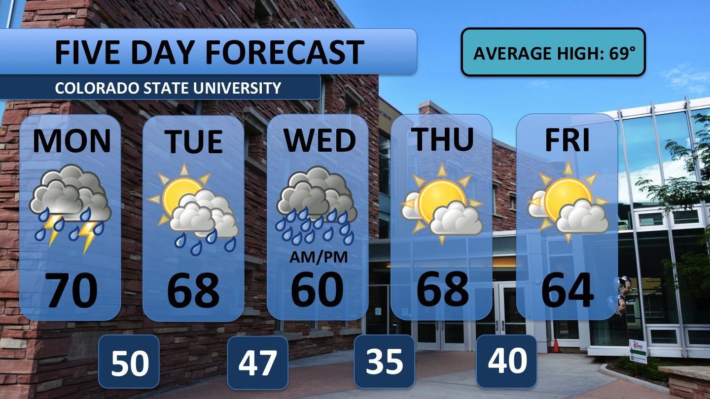
Tuesday will see plenty of cloud cover again, but the storms look much weaker. A stray shower in the mid-afternoon is the best bet for any precipitation.
Wednesday, however, will see the return of rain-packed storms. Additional heavy rainfall is expected all throughout the day, and it will be significantly cooler too.
By Thursday and Friday, the upper-level low pressure will migrate away from the area. This ushers in much drier air. Mostly sunny skies and seasonal temperatures return. The weekend looks to be in the low 70s and sunny.
Have a great Monday! Stay weather aware, don’t forget an umbrella and keep it here for all your weather updates!


