

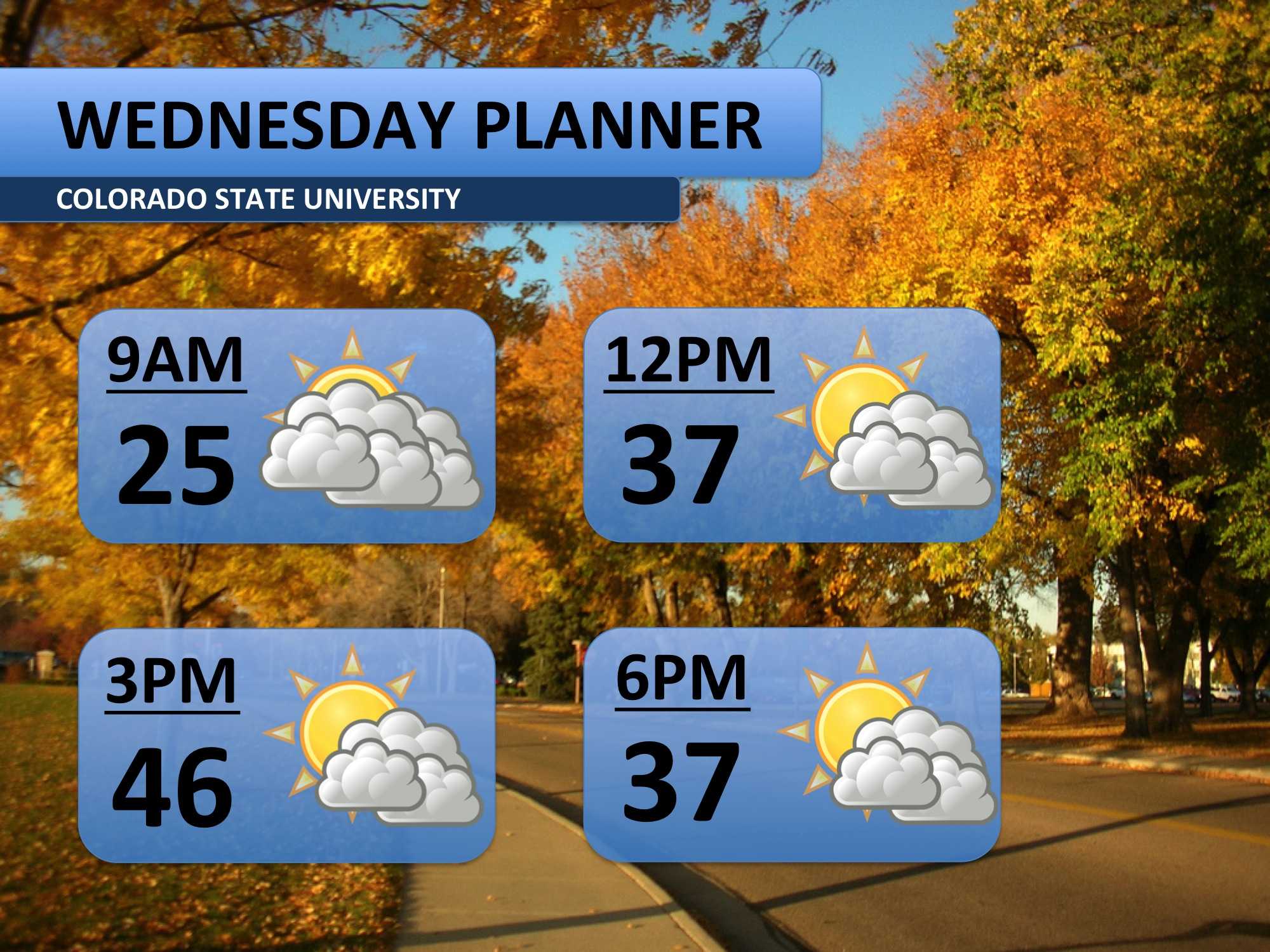
Monday’s high temperature peaked at 48 degrees, and Tuesday should follow a very similar pattern. Clouds should be pretty widespread on your wakeup, but they should thin out some throughout the day. This will allow temperatures to again rise into the mid-40s.
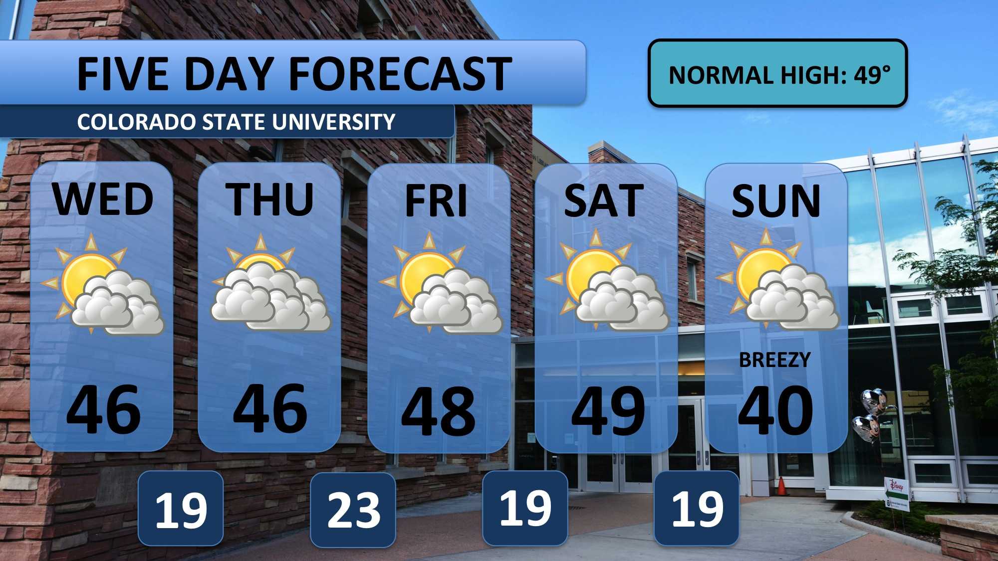
Snow and rain are forecasted to stay out of the forecast for the next several days. Expect 40s with partly to mostly cloudy skies through Sunday. Friday, as everyone leaves, dry conditions will dominant the entire state. This should make for an easier drive home.
A system approaches the area Sunday evening, bringing a stiff breeze along with it. Snow will stick to the mountains with this system, which could pile another six inches onto current mountain totals. Fort Collins and the front range will likely miss out on the moisture from this system.
Meteorologist Austin Harley can be reached on Twitter: @wx_harley.


