

Although the leaves are changing, and Tuesday marks the first day of fall, the summer-like weather has decided to stick around for a few more days. And you know what that means… grab the sunglasses and shorts!
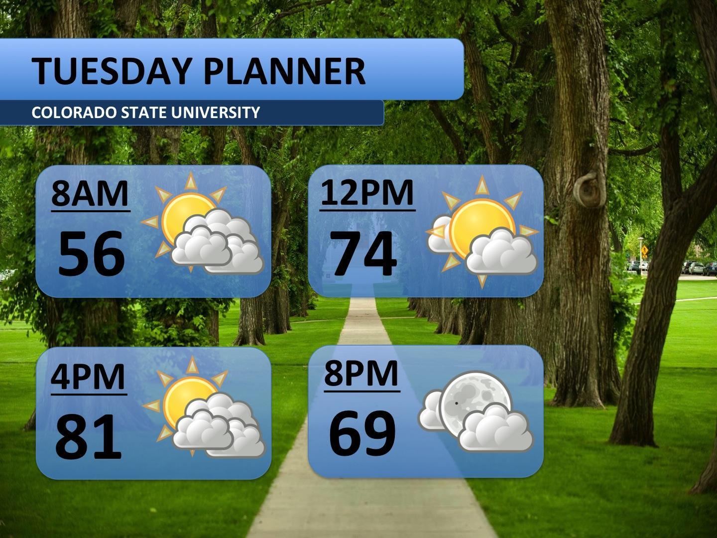
Tuesday looks like more of a transition day. As cooler, wetter weather shifts east, temperatures in Fort Collins will continue to get warmer. A bit of leftover moisture will allow some clouds to develop — partly sunny skies are expected. Storms are forecast to stay off to the west, not impacting CSU or the city. Tuesday afternoon should top off in the low 80s.
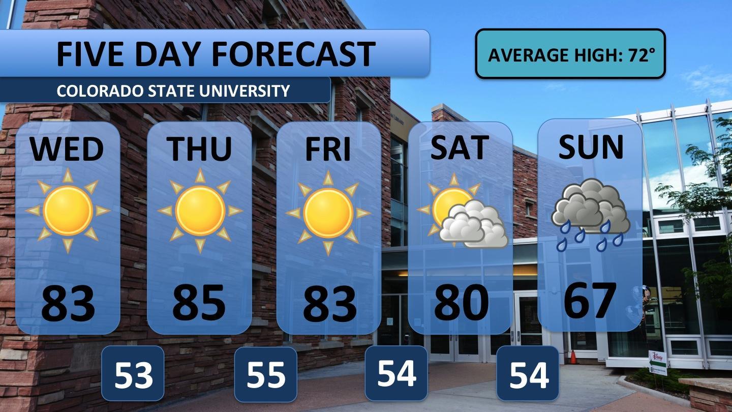
Similar to last week, an area of high pressure settles over the region. This will allow warm, dry air to control the region for a majority of the week. In fact, sunny skies are forecast through Friday with temperatures staying about ten degrees above normal. Enjoy this little taste of summer as it appears to be the last 80s we’ll have for a while.
Saturday looks like another transition day. Moisture, from a system over the desert southwest, will begin streaming into Colorado. Clouds build Saturday, but the bulk of the moisture and energy is pegged to arrive Sunday. Significant cloud cover and possibly heavy rain will result in below normal temperatures. I’m sure many would welcome a relief from the heat!
To ask weather-related questions or provide feedback on this forecast, contact Austin Harley on twitter: @wx_harley. Have a great, Tuesday!


