CIRA, NOAA bring atmospheric science, research to CSU
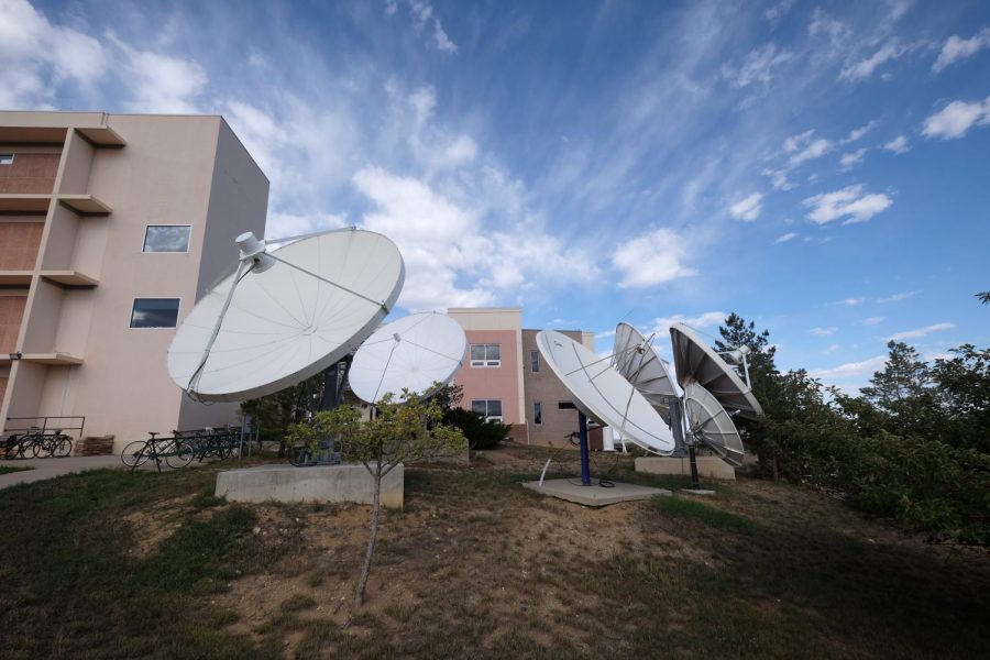
Photo courtesy of the Cooperative Institute for Research in the Atmosphere.
October 12, 2022
The Cooperative Institute for Research in the Atmosphere and its partner, the Regional and Mesoscale Meteorology Branch, work with the National Oceanic and Atmospheric Administration to conduct atmospheric research on storms to better prepare residents across the country for severe weather situations.
With Hurricane Ian’s recent landfall in Cuba, Florida and South Carolina, the CIRA team’s satellite imagery was picked up and used alongside coverage in news sources including The New York Times, BBC News, ABC News and CNN.
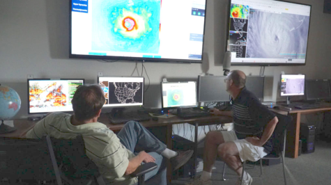
“It was a very concerning storm for us to track in terms of the the differences with Ian versus other storms in the past,” said Steven Miller, director of CIRA and a professor of atmospheric science at Colorado State University.
“Only recently have we had this newer generation of geostationary satellites, which are capable of providing very high space and time resolution imagery,” Miller said. “We were able to track the storm in ways that could not be done in years past; we’re really able to drill down into the structure of the storm, see details of the inner eye and the dynamics going on within that area and really supporting NOAA in terms of understanding what that storm would be doing next.”
Geostationary satellites are satellites that are launched into Earth’s atmosphere and remain at a fixed point in orbit while capturing images of Earth. The satellites move in time with the planet, providing continuous high-definition imagery of the Earth.
“We’re positioned at Colorado State University so that we can couple with the atmospheric science department principally — but other colleges and departments within the university — to tap into academia and the basic foundational knowledge that’s generated in this national highly ranked university and to take that information and turn it into actionable tools and things of practical use for society.” -Steven Miller, director of the Cooperative Institute for Research in the Atmosphere
CIRA currently has three geostationary satellites in orbit through their Geostationary Operational Environmental Satellite — R Series project. The first GOES-R satellite, GOES-16, launched in November 2016 and was followed by GOES-17 in March 2018 and GOES-18 in March of this year. According to the GOES — R website, the GOES-R series of satellites will be completed with a launch of another satellite in 2024.
“There’s so many cool satellites that we’re trying to get up into space,” said Matt Rogers, CIRA research associate and education and outreach coordinator.
“We work very closely with NOAA and NASA in terms of instrument development,” Rogers said. “With geostationary satellites, in addition to weather, we can learn all kinds of interesting information from seeing the Earth at night, like power outages. We can see that from space, and we can get a sense of how big the outages are and how much resources we might need to allocate from the federal government, for example.”
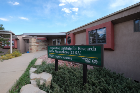
NOAA and CIRA formed their partnership in 1980: a four-decade ongoing partnership in atmospheric research headquartered at the Colorado State University Foothills Campus.
“We’ve worked through several generations of meteorological satellites,” Miller said. “It’s all for helping society make the most out of investments in the space and taking advantage of these really neat sensors that are flying up there in orbit that can take pictures of the weather and the weather in motion and tell us all different kinds of things about what’s going on right now.”
CIRA’s connection to CSU combines the atmospheric science department with CIRA and RAMMB’s research and resources to expand access to academic professionals at CSU as well as technology and resources within CIRA.
“We’re positioned at Colorado State University so that we can couple with the atmospheric science department principally — but also with other colleges and departments within the university — to tap into academia and the basic foundational knowledge that’s generated in this national highly ranked university and to take that information and turn it into actionable tools and things of practical use for society,” Miller said.
CIRA’s main goal with severe weather imagery is to better guide forecasts and public safety warnings.
“I think sometimes it’s hard to understand forecasts, especially when you have a landfalling hurricane that’s hitting a major populated area,” Rogers said. “Storms like Ian give us a real opportunity to figure out exactly how to get the forecasting and evacuation messaging across better. If satellite imagery helps with that, then we want to be present any way we can.”
In addition to hurricanes, RAMMB’s geostationary satellites primarily monitor air quality, blizzards, fires, volcanoes and dust storms, according to CIRA’s satellite library.
“We’re working to help NOAA anticipate, better predict and better give guidance to forecasters, which are ultimately advising you and I about when to take shelter, when to evacuate and what to look out for in the near future,” Miller said.
Going forward, Miller hopes CIRA will continue to stay on the cutting edge of satellite research to better inform the public of severe weather emergencies.
“We’re working to continuously get better and better prepared for these kinds of events in the future,” Miller said. “With a changing climate, perhaps we might anticipate some storms happening differently than they have in the past in terms of where they form, how intense they become, how many storms we might see and where they go. As we enter this new paradigm, we’re going to really be more and more reliant on the observations, the models and the forecasts of these storms so we can give the public the best possible guidance.”
Reach Allie Seibel at news@collegian.com or on Twitter @allie_seibel_.