Mapping from spreadsheets onto coordinates that represent geographic locations makes data easier to read. Students and staff at the Geospatial Centroid at Colorado State University are using this technology to create more visual forms of data sets.
Wednesday is GIS Day, and beginning at 10 a.m., events will take place in the Morgan Library Event Hall. The day dedicated to GIS, which stands for Geographic Information System, will conclude with a mapathon at 4 p.m. at the Ramskeller in the Lory Student Center.
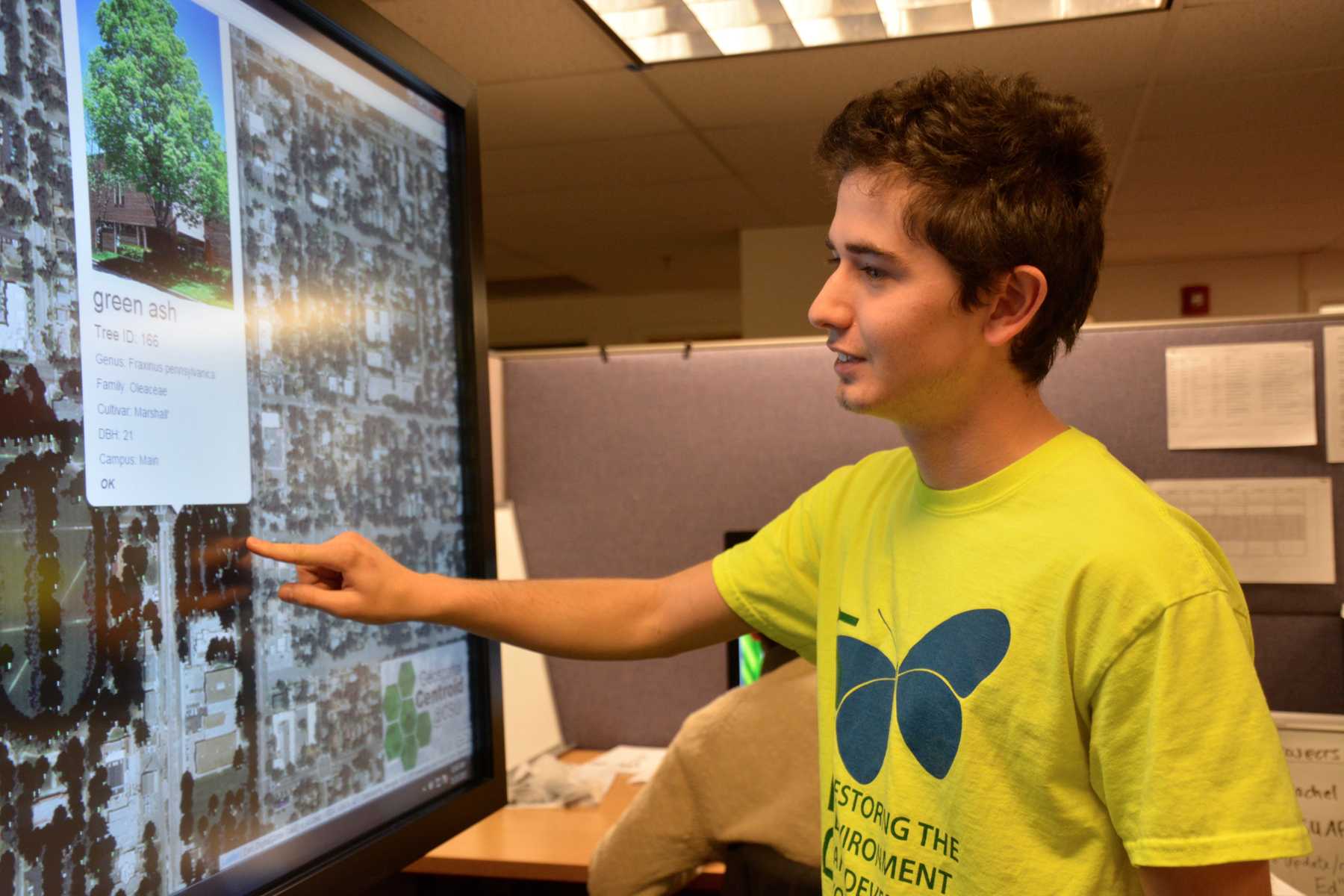
“GIS is basically putting data on maps, because with most data, you can have a location for it,” said Riley Ross, a sophomore in natural resource management, who is also an intern at the Geospatial Centroid at CSU.
The Centroid has been at CSU for about five years, but has been housed in the Morgan Library for just under two years.
“Anything that can have a location tied to it can be brought into this system, and then you can observe patterns,” said Sophia Linn, assistant director of Geospatial Centroid at CSU. “We want the CSU community to be aware that it exists and that it might be something that they might want to learn about.”
Karam Ahmad, a master’s student in public health in epidemiology, said he was first attracted to the Centroid at CSU because he was doing a tick surveillance project for the National Park Service and stayed on as an intern at the Centroid.
“(GIS) is making sense of the world through mapping,” Ahmad said.
One of the ongoing projects at the Centroid concerns mapping the locations of gunboats attacking plantations during the Civil War.
“The History Department wanted to put all the Civil War gunboats attacking plantations along the Mississippi and other rivers,” Ross said. “They were using GIS to figure out if there was any correlation there — the project is still in the beginning phases.”

The GIS Day event at CSU is one of several going on in the United States and around the world.
“It is a global event,” Ahmad said. “There are hundreds of these events going on around the world, not just in the United States.”
Linn said the Geospatial Centroid works with the Alternative Transportation Office at CSU to track bus routes and find where there might be gaps in service, as well as find where traffic of people is heaviest.
“It’s the kind of data that people can clearly see that can help inform decisions,” Linn said. “It’s easier to tell stories when people can put it in context of the real world. You’re able to do analysis between data layers that you may not have seen before.”
The mapathon in the Ramskellar from 4-6 p.m. will contribute to efforts across the world.
“We will be mapping to help the humanitarian efforts going on in Senegal right now,” Ross said.
CSU will take part in one of about 50 different mapathons going on, Linn said. Mappers will be using OpenStreetMap to contribute data to “the Wikipedia of the mapping world,” Linn said.
Collegian Reporter Megan Fischer can be reached at news@collegian.com or on Twitter @MegFischer04.