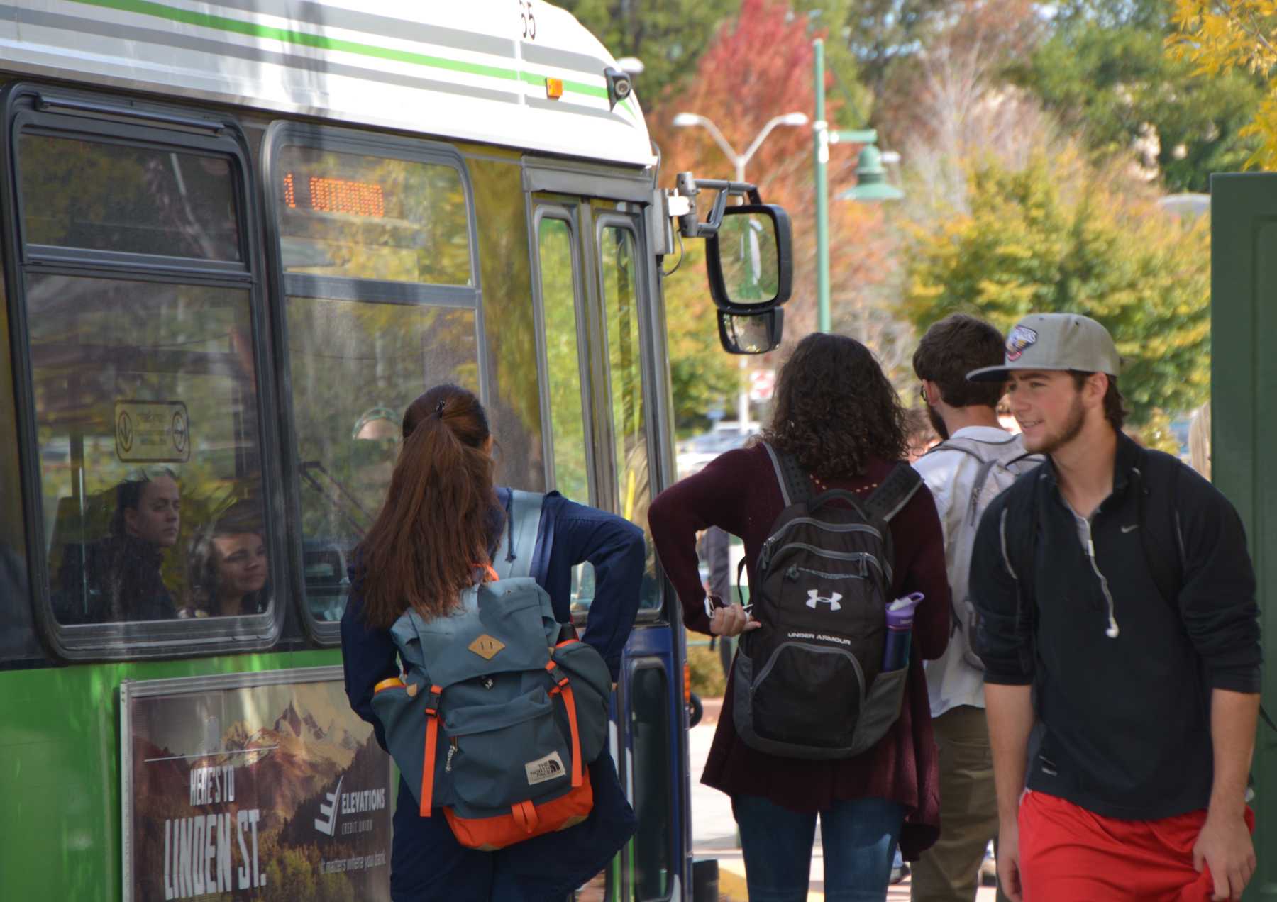
Mapping alternative transportation use by Colorado State University students and employees is helping advocate for infrastructure improvements and changes — all of the mapping and data collecting is done in-house.
The Geospatial Centroid is working with CSU’s Alternative Transportation Department to create maps of the location of bus stops and other alternative transportation infrastructure in relation to where students and faculty live. This assures that alternative transportation options are convenient and usable for the CSU community.
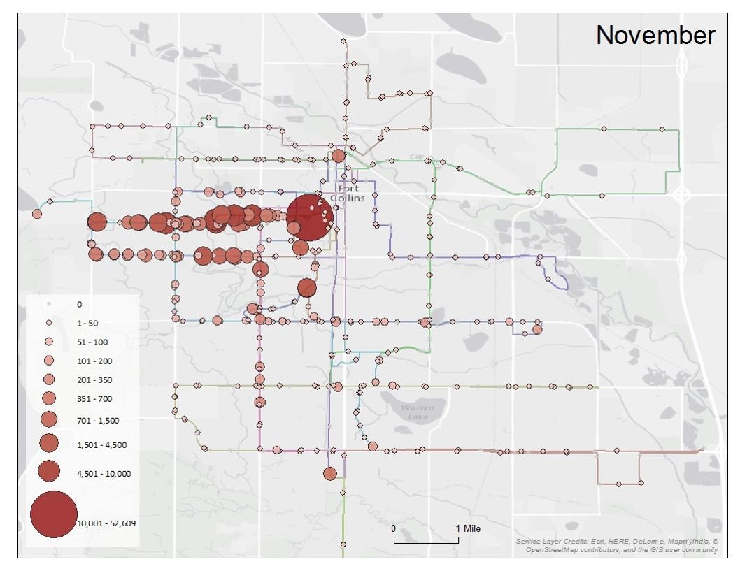
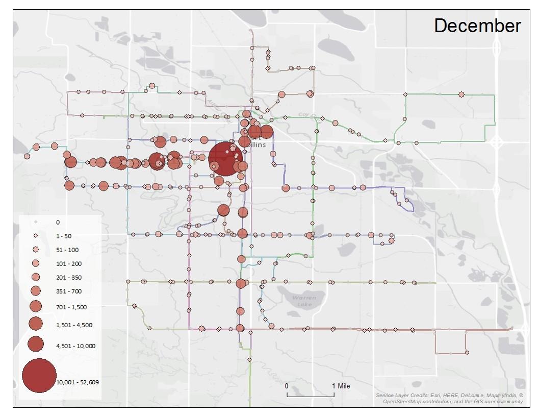
Brandon Lemire, technical manager at the Geospatial Centroid, said geospatial services are provided for Alternative Transportation, producing maps for a variety of projects, including monthly maps showing where the most-used bus routes are.
“Aaron (Fodge)’s group (in Alternative Transportation) is really interested in advocating for the faculty and students on campus – it’s really important to their mission,” Lemire said. “Part of that advocacy is providing students and employees with what we all feel is above average access to University services.”
The maps created by the Centroid assist in planning projects within the transportation department, specifically alternative transportation. These projects include installing bus shelters, creating crosswalks and anything else that helps improve alternative transportation in the city and on campus.
Alternative Transportation Manager Aaron Fodge said he uses these maps to advocate for students and employees and get them better transportation infrastructure and services.
“If I didn’t have a map that depicted (alternative transportation uses), it might be really difficult to justify some of the things we spend money on around here, like transit,” Fodge said.
Because of these mapping projects, the Alternative Transportation Department was given a grant to create a bicycle crosswalk on Shields Street. Fodge said he sent engineering students out to Shields Street to count bicycles crossing onto campus. 966 crossings south of Elizabeth Street were counted.
Fodge said with that data, the area was mapped with a half-mile buffer, which showed over 1,000 employees and 1,000 students living within that buffer. Fodge is also asking the city to prioritize plowing that route on snowy days.
“So if you live (within the buffer), you could easily ride down here and then have a plowed route into campus,” Fodge said. “This also got us a grant that brought in money to do that crossing.”
Fodge said they used the bus route maps to show how well-used the new bus routes on the foothills campus are. In November, when only one stop existed, it showed about 100 people using that stop per day. In December, when additional stops were added to that area, it jumped to around 100 to 200 people per stop.
“I can’t tell this story any other way than (with a map),” Fodge said.
Lemire said RamCard data is used to see how many students and employees take transit and which routes they take.
“It gives us and idea of, not who, but how many students and employees are getting on the buses,” Lemire said.
Other maps include places where the most bicycle accidents and bicycle enforcement tickets are located.
“I’ve just been focusing on bike tickets,” Centroid intern Chrissy Esposito said. “I feel like the bike tickets (are) really to help the bike cops know which areas need more attention because students aren’t following the law.”
They will also be using the data from the recently installed bike counters on campus to identify high-traffic areas and identify potential infrastructure improvements, such as widening the bike trails or adding bike parking.
Fodge said, for most of these maps, they use the local addresses for all students and employees that are on file with the University. For mapping purposes, only the location of where a student or employee lives is identified — no other personal information is included.
When making a map for something such as bus route uses and locations, Fodge said the maps include a buffer.
“A buffer is – take a center point and draw a buffer around it – and a buffer is a distance,” Fodge said. “A half-mile buffer around a bike route means, within a half-mile is about a minute or two bike ride.”
Fodge said the Centroid at CSU gives students real-world experience in this field.
“I think Aaron is innovative,” Lemire said. “From what I’ve seen this is a very unique project. He’s really been looking at ease of access, he’s been looking at safety, as well as how to educate the community on how to use these resources.”
Fodge said the Centroid took much of the work off of his department, specifically with more data-intensive maps, such as mapping where employees and students live.
“That’s what it’s all about – it’s being able to look at the picture of what’s really going on based on real data and then you visualize it and it’s very clear where the issues are,” Centroid Assistant Director Sophia Linn said.
Collegian Breaking News Editor Sady Swanson can be reached at news@collegian.com or on Twitter @SadySwan.