


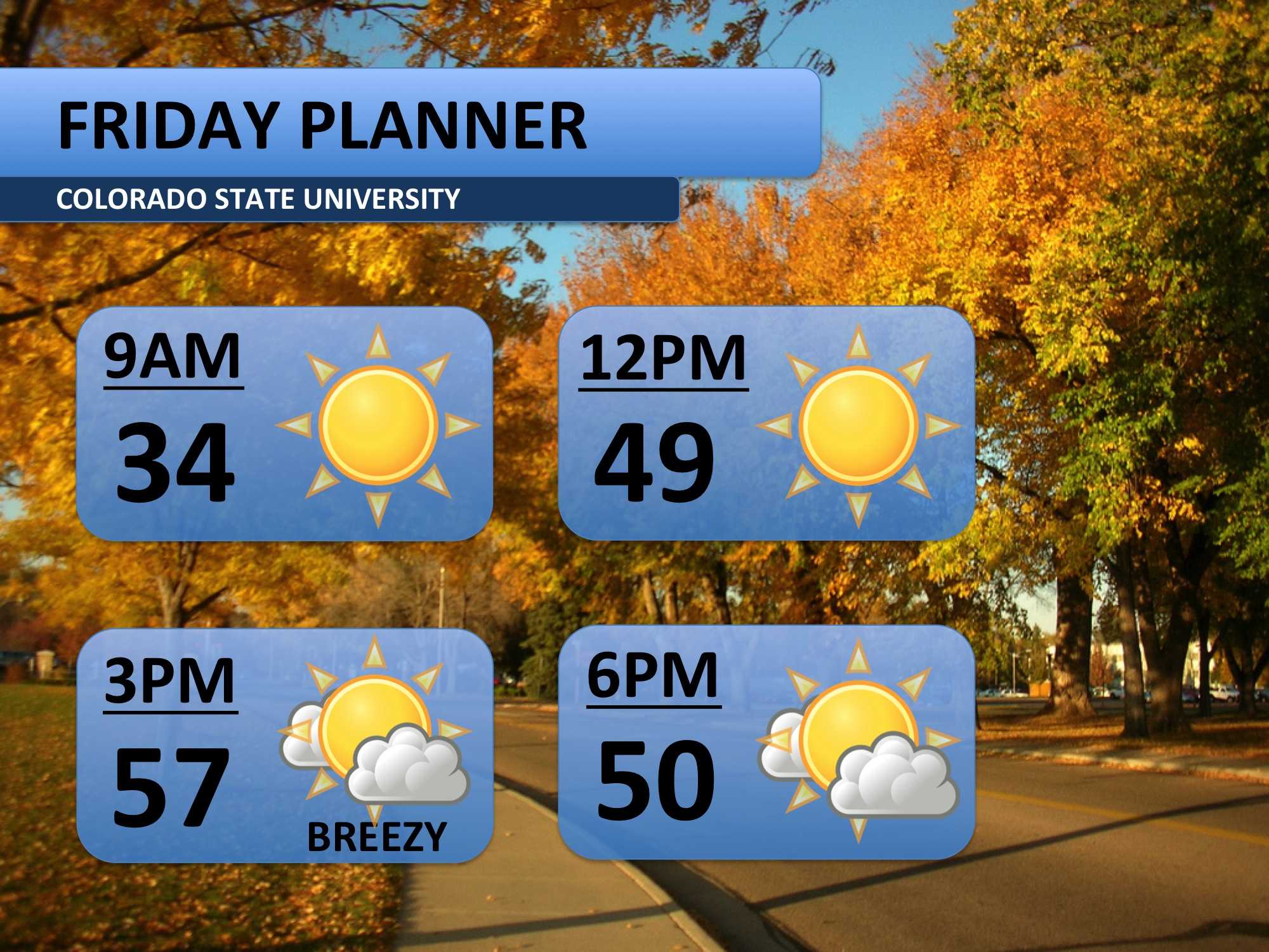
Happy Halloween! Friday’s forecast is a bit cooler than yesterday’s; a cold front pushed through the area overnight leaving us a few degrees below average. Friday morning will be especially cool. Skies should remain mostly sunny throughout the day, but expect a bit of a breeze this afternoon.
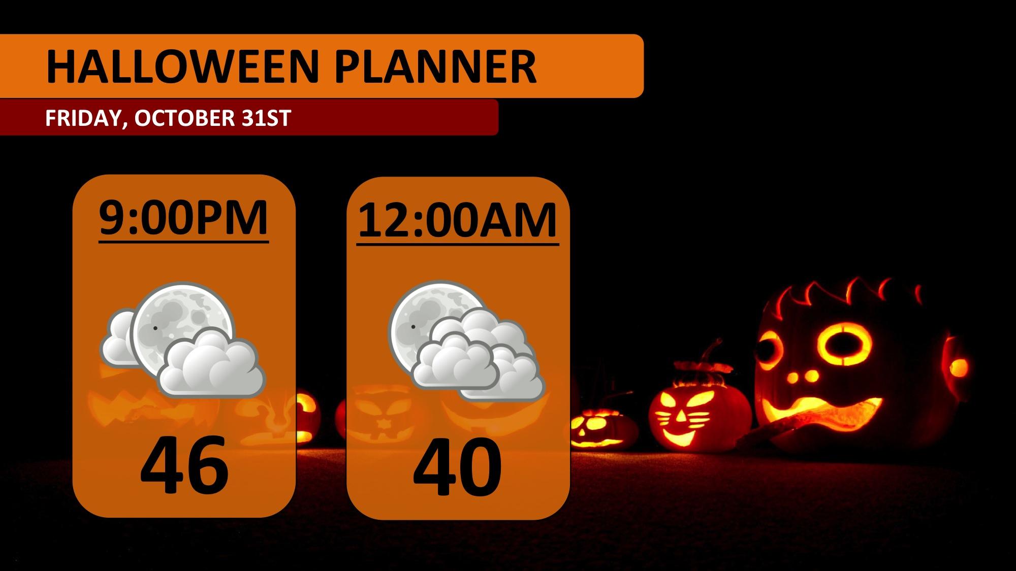
For those of you planning to celebrate the spooky holiday this evening, plan to bring a jacket along. Winds should die down, but upper 40s are likely for the early evening. Temperatures will fall into the 30s after midnight, so be prepared if you have late night plans. Stay safe!
After a bit of a cool down today (Friday), some warmth will return on Saturday. The winds should be calmer for the first half of the weekend too. By Sunday afternoon, the next weather system will bring rain showers and cooler air to the area.
Here’s where it gets tricky. Different forecasts vary from light rain to a few inches of snow on Monday. At this point in time, it looks like rain showers will persist through Sunday night and into the daylight hours of Monday. There may be a mix of snow at times, but I wouldn’t expect any accumulation. Be ready for a colder day though! Temperatures are pegged to be in 40s all day.
Tuesday morning bottoms out at a chilly 27 degrees, and then the day gets a bit warmer. The wet weather should have migrated from the area by then.

Meteorologist Austin Harley can be reached on Twitter: @wx_harley.


