

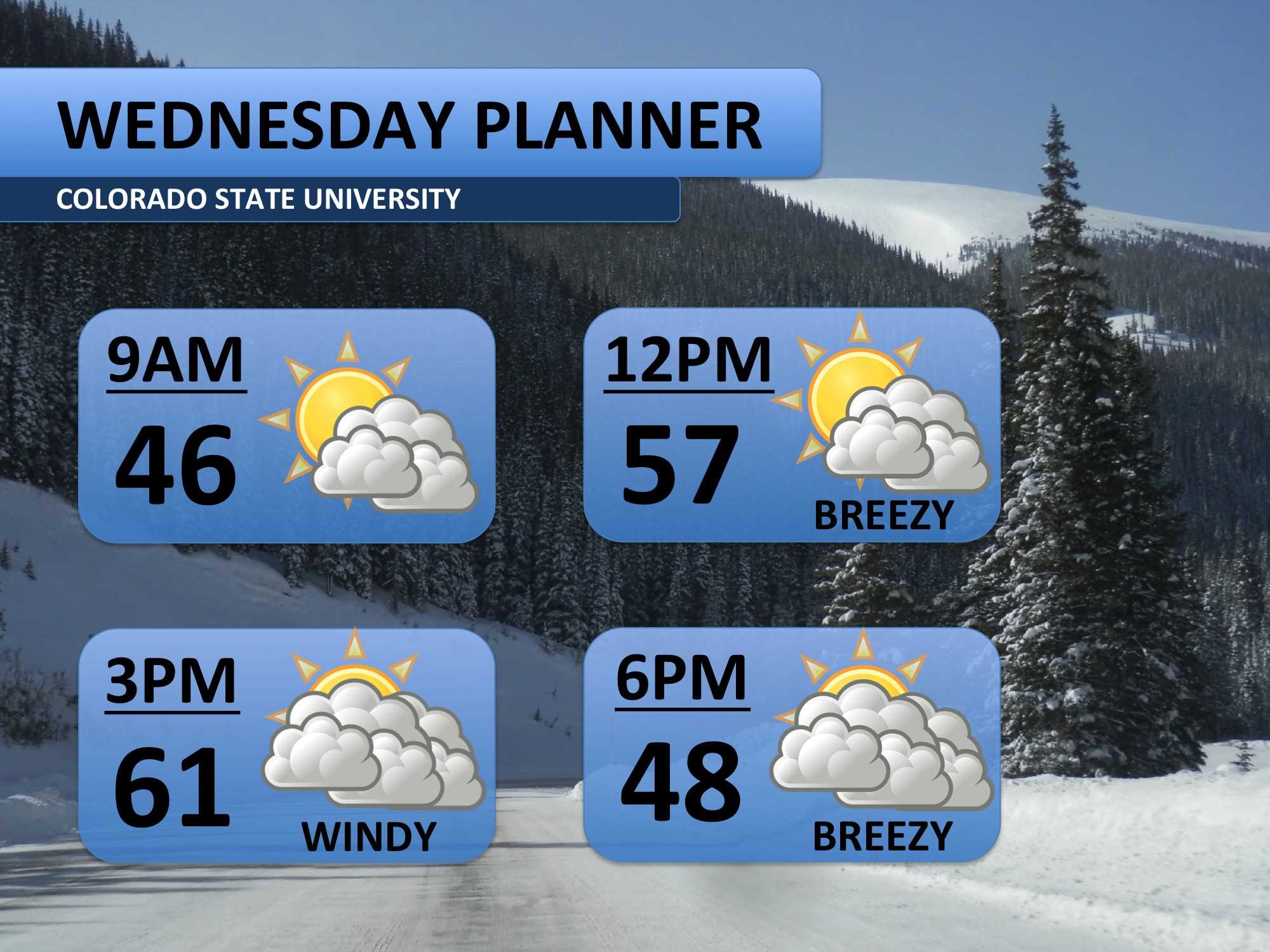
After another record high temperature was recorded on Tuesday, temperatures are forecast to become less extreme on Wednesday. More clouds throughout the day will hold temperatures to the 60s. The mountains will experience some light snow showers, but we’ll only have gusty winds in Fort Collins.
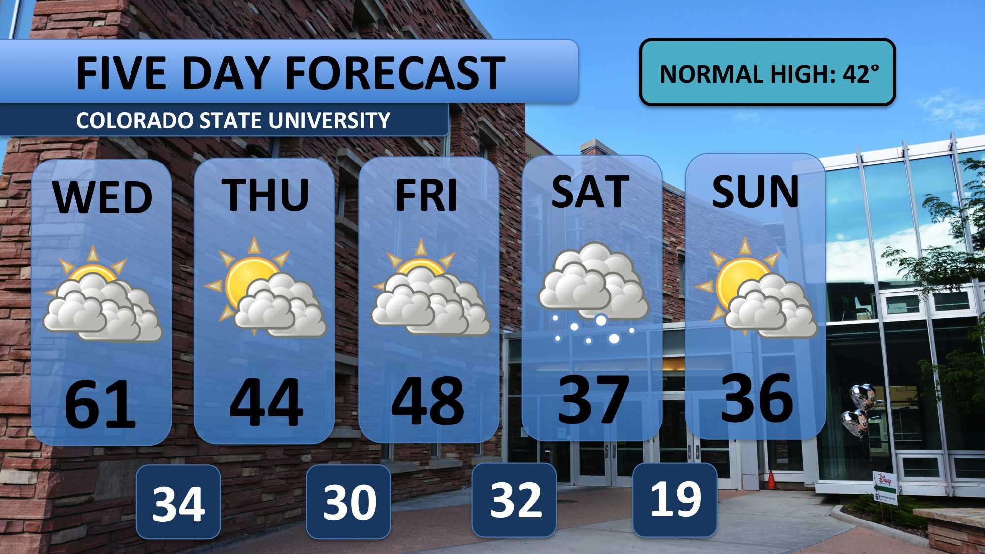
It’s all downhill from here, folks. Temperatures will continue to fall throughout the next five days. Weak systems will continue to build clouds into the region through Friday. Throughout Saturday models are projecting around two inches of snow. Cold weather is forecast to stick around into Sunday too.
Meteorologist Austin Harley can be reached on Twitter: @wx_harley.


