

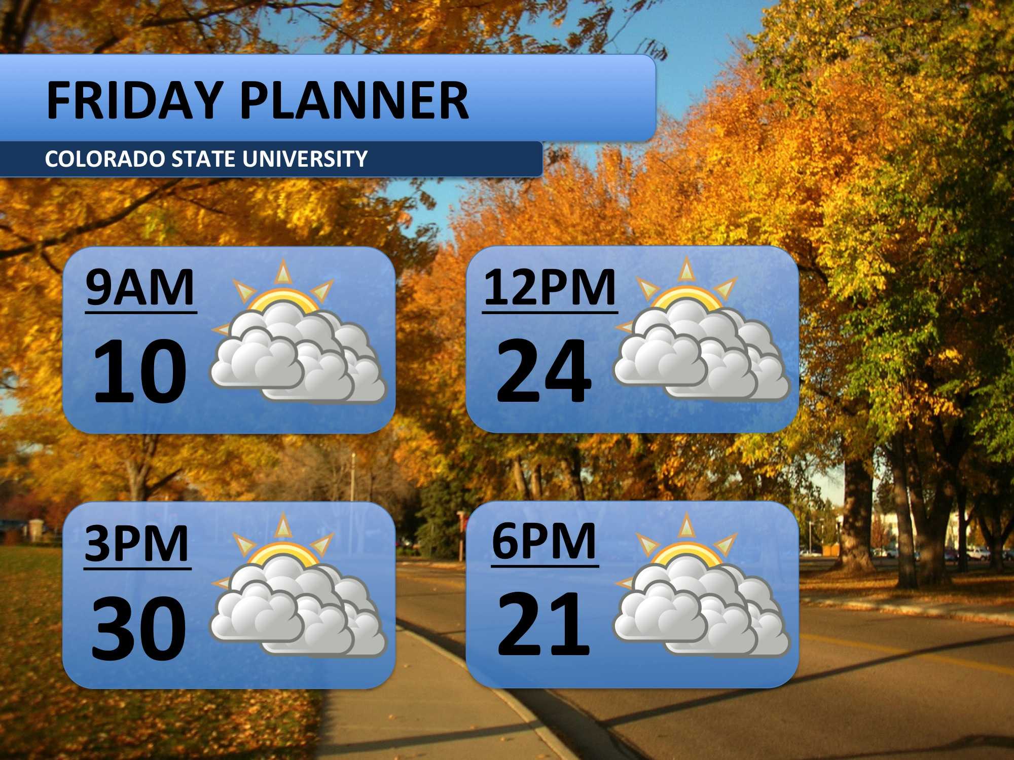
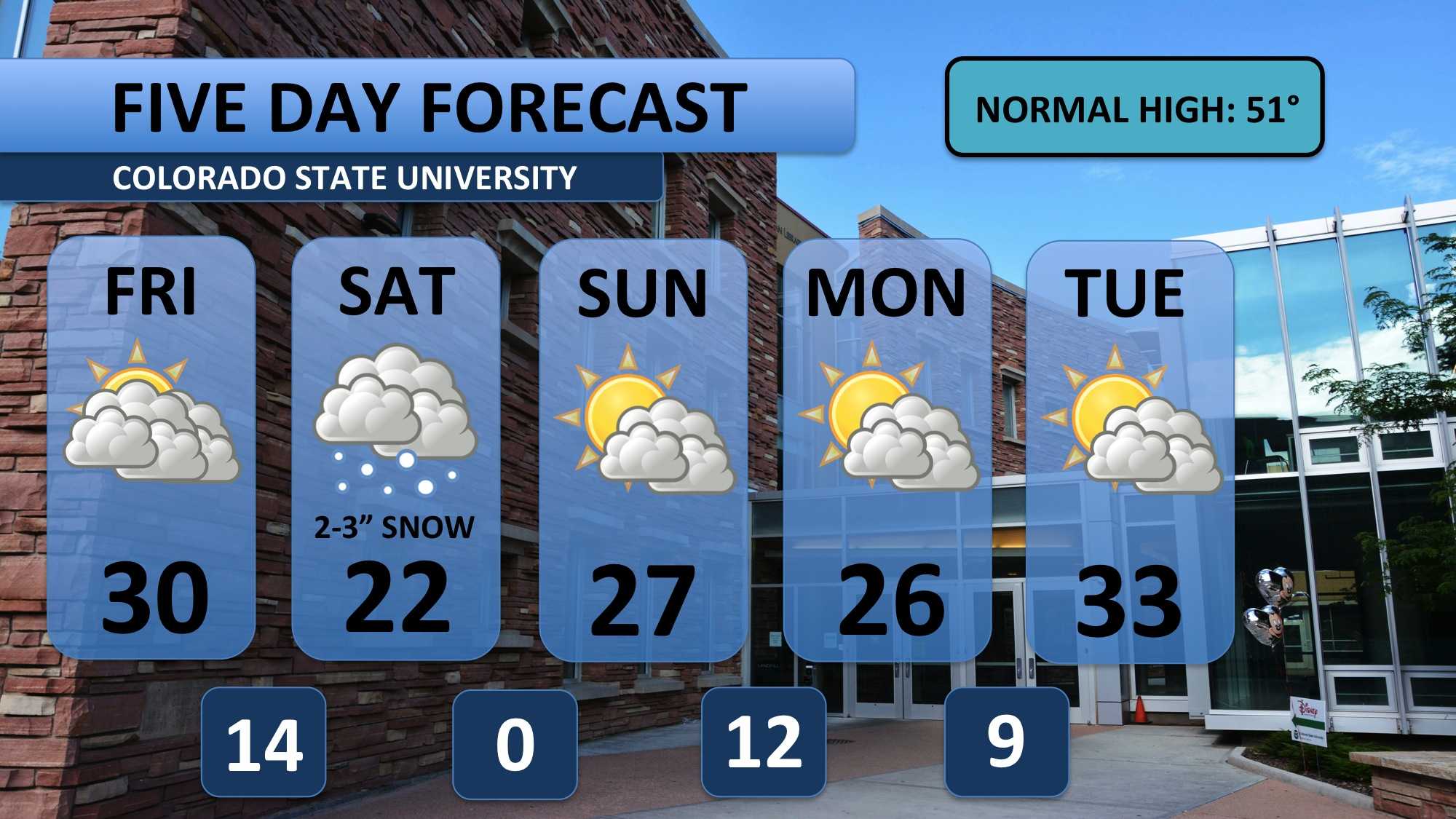
Several days of single digit temperatures has left Fort Collins snow packed and frosty. Luckily, double digit temperatures will return Friday. Temperatures in the upper 20s and possibly 30s will bring a welcome relief. Snow stays out of the forecast today too. This will be brief break from winter weather as another round is forecast to arrive Saturday.
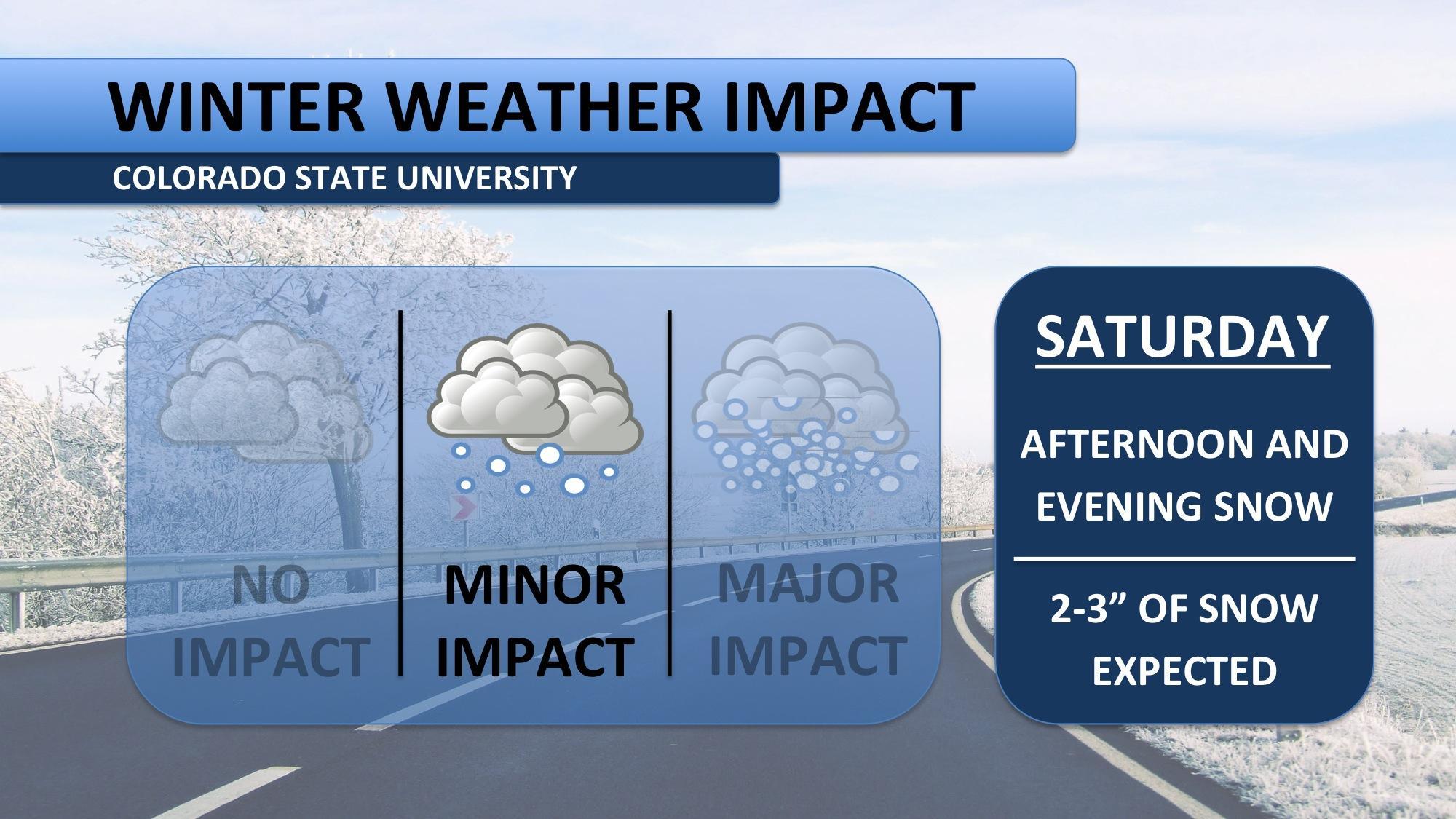
Clouds will continue to build into the area on Saturday morning. A cold front should push through before noon, and with it, expect temperatures to fall and a breeze to pick up. Snow is forecast to fall Saturday afternoon into the evening. Freezing air and soil temperatures will allow for good accumulation. Expect up to three inches of snow before midnight.
Mountain travel may be difficult this weekend. West of the Continental Divide (Aspen, Steamboat) is under a Winter Storm Warning for up to ten inches of snow, so be ready for a slow go up that way. A Winter Weather Advisory is out for areas near Eisenhower Tunnel and Breckenridge, where six to eight inches of snow is forecasted. Snowfall will begin in the mountains Friday morning and continue until early Sunday morning.
We’re still about 30 degrees below average for the next five days. After Saturday’s snowfall, the precipitations will quiet down for a bit. The good ole’ Colorado sunshine returns Sunday and sticks with us for most of next week! We may even make it into the 40s late in the week, just in time for the drive home.
Meteorologist Austin Harley can be reached on Twitter: @wx_harley.


