

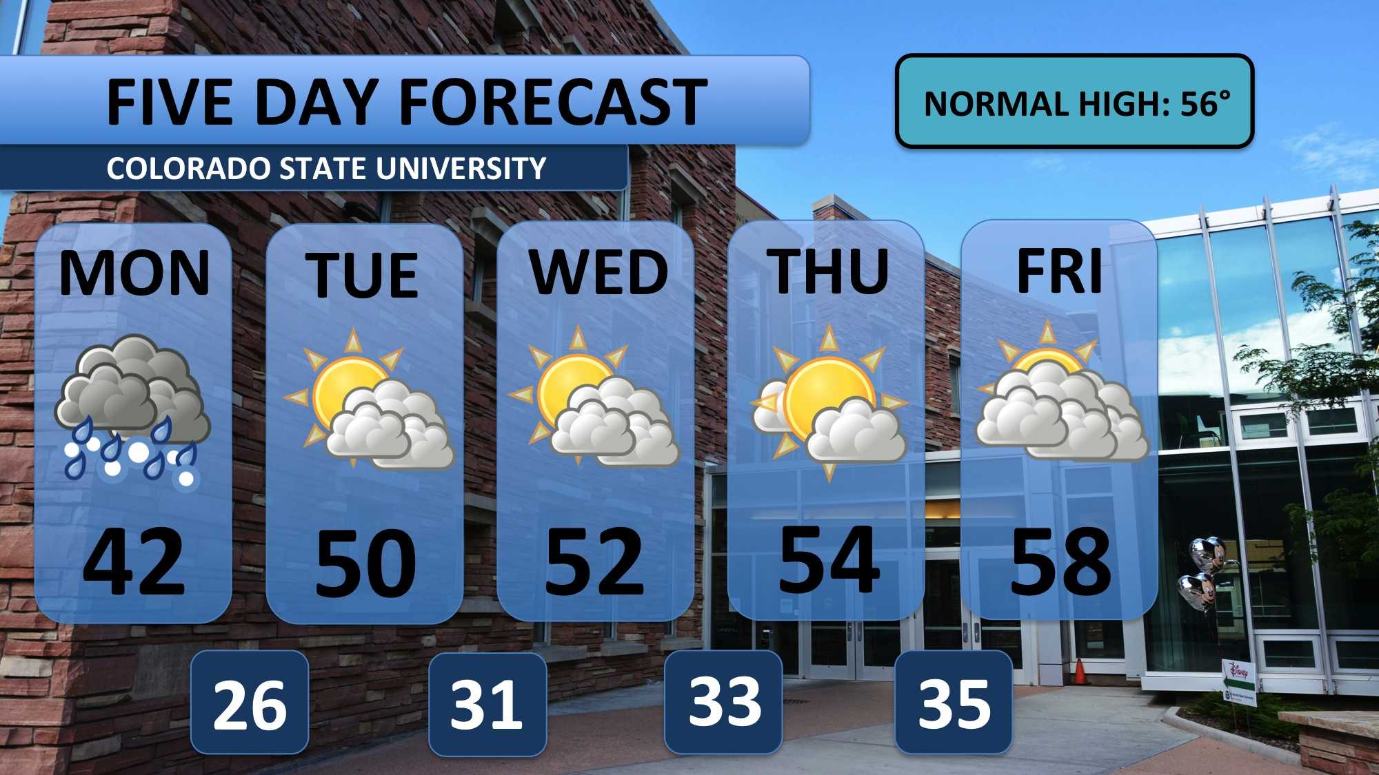
A cool weather system began bringing rain/snow to the area early Monday morning. This rain, snow and a mix of the two are expected to continue till about noon. Temperatures will be very cool, and a breeze will make things feel even cooler. Precipitation should taper off during the mid-afternoon. Skies will remain cloudy. Bring a jacket, scarf and umbrella today. 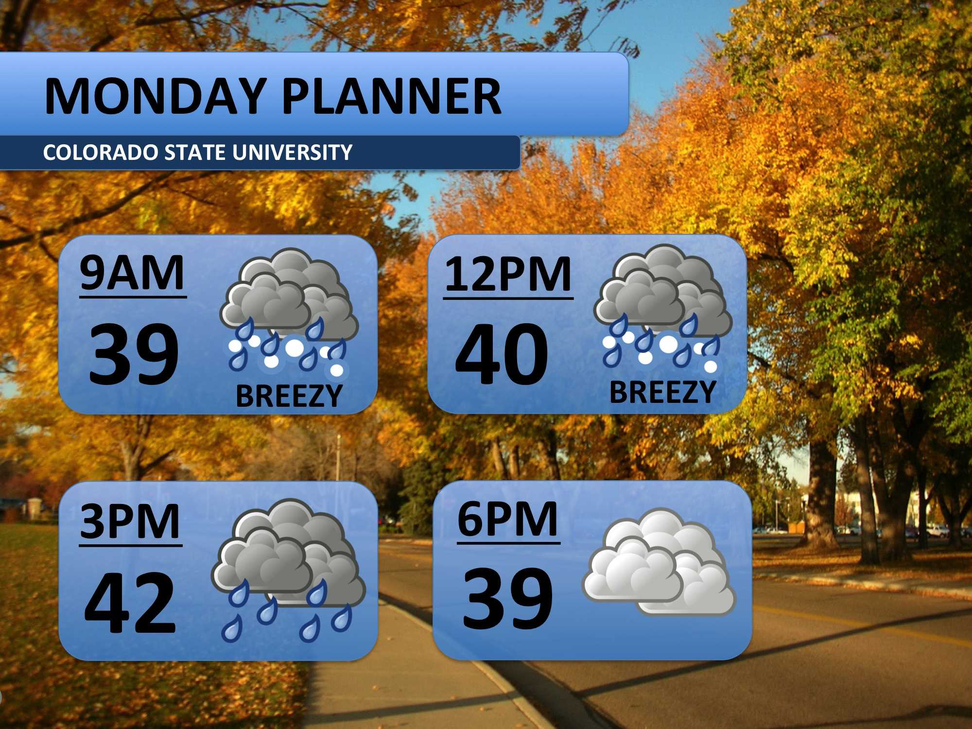
Several inches of snow are expected to the west of Fort Collins — good news for the ski resorts! Locally, most of the snow that falls will be mixed with rain. After weeks of above average temperatures, the ground has become very warm, so snow will only show up on the grass. Roads will only be a bit slushy. Shoveling will not be necessary. Overall, don’t expect any major travel impacts from this storm. Plan a little extra time for foothill or mountain travels.

After a cool Monday with temperatures in the 30s and 40s, the weather will dry out. Expect a return to seasonally average temperatures. Partly cloudy skies will persist through Thursday. Nighttime lows are transitioning to become pretty chilly. Friday will be the next opportunity to see some precipitation, but there’s some disagreement on the event. I’ve added a few clouds and kept the forecast dry for now. The weekend looks to be dry at this time.
Meteorologist Austin Harley can be reached on Twitter: @wx_harley.


