

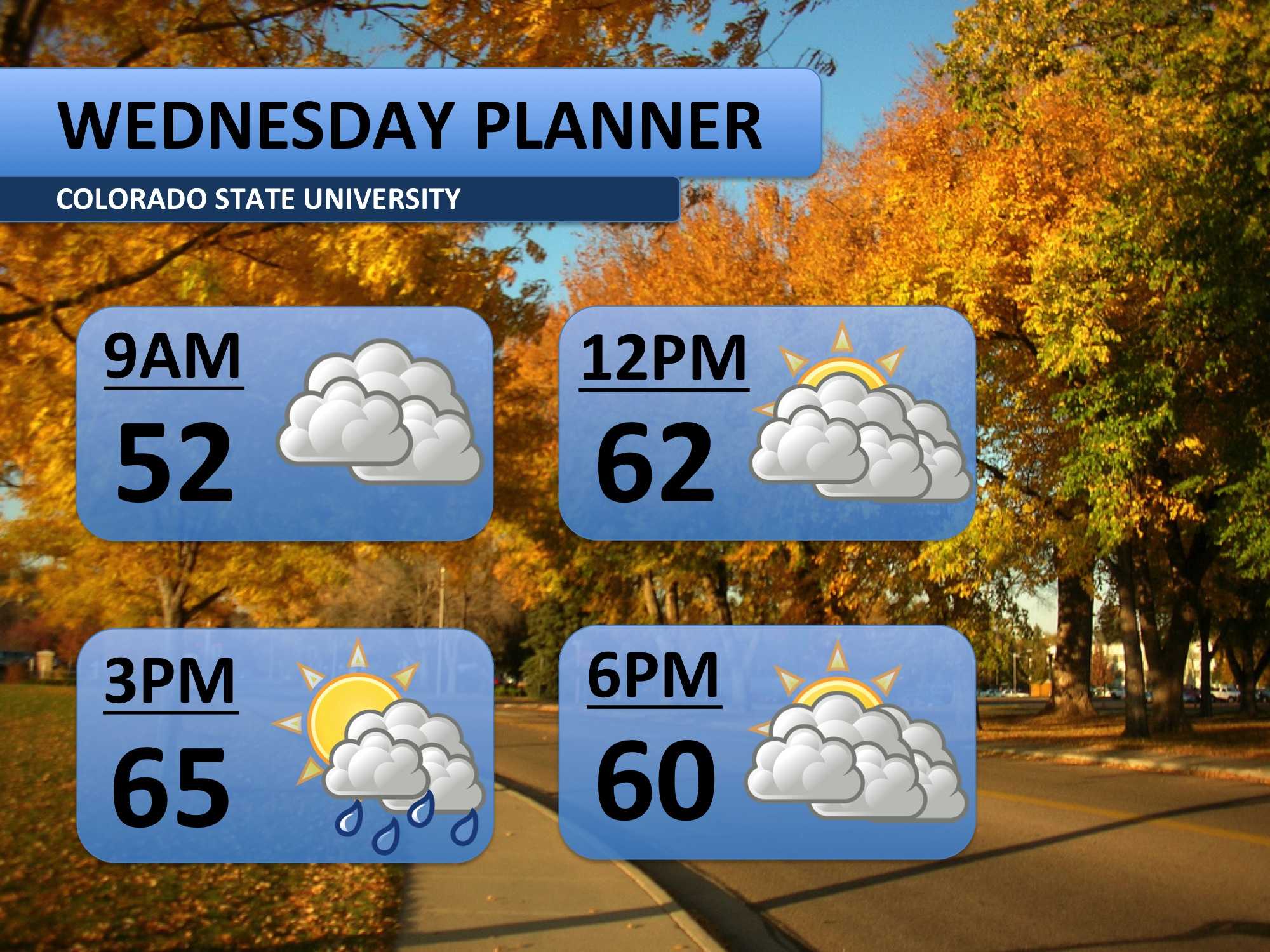
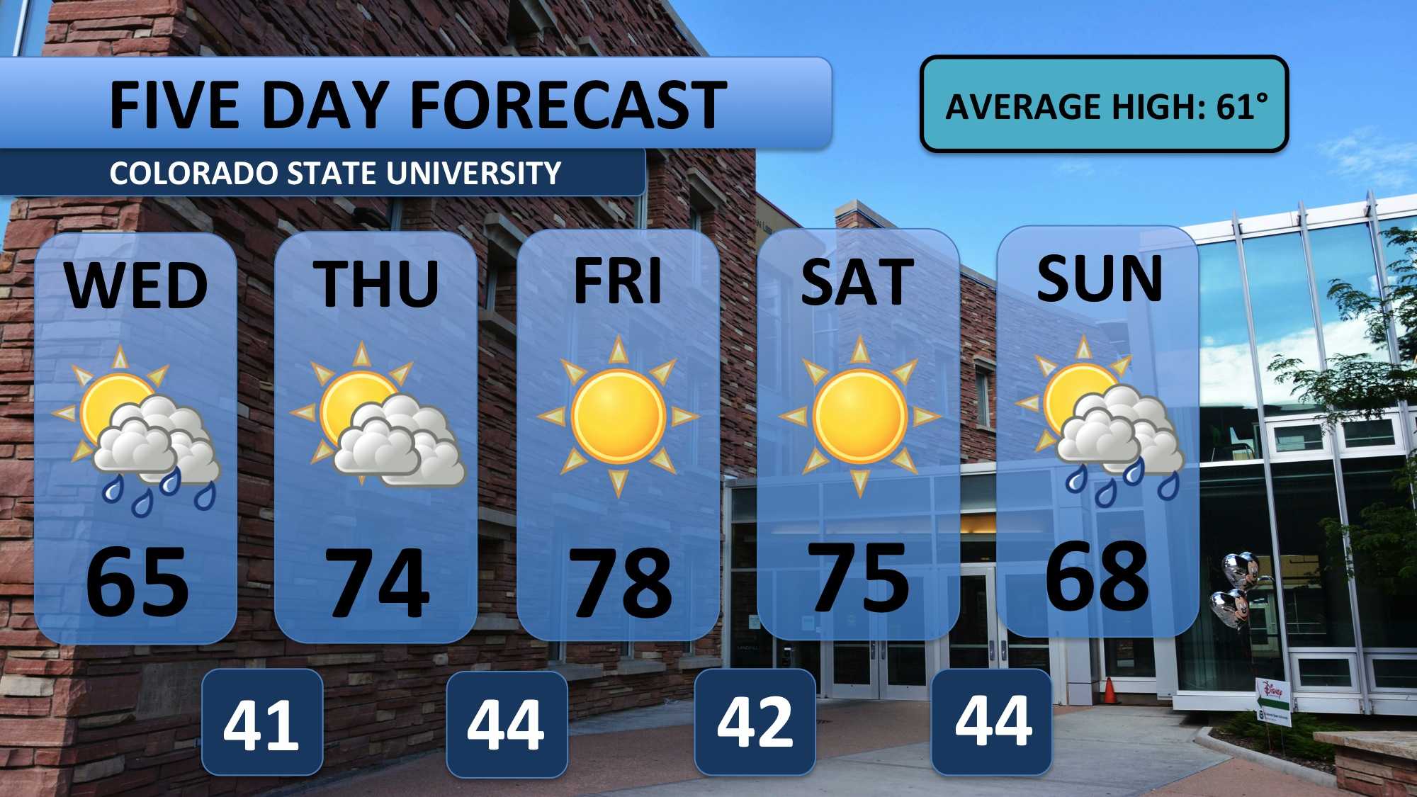
Showers throughout Tuesday night and Wednesday morning will end by about 6:00am. Clouds and cooler temperatures will remain in its wake on Wednesday. Some light drizzle may fall before 9:00am. You’ll want a jacket all morning long as temperatures stick to the 50s. Clouds will be pretty thick into the afternoon too. Expect a light shower sometime in the afternoon.
Wednesday will be more typical for this time of year, but the system bringing the cooler weather will quickly move away. By Thursday, 70s return to the forecast. Friday will deserve some special attention as temperatures near 80. I currently have 78 forecasted, and that is the record high for that day!
Saturday will continue to be very warm and sunny as well. Another system of unsettled weather is expected to arrive Sunday, and it will be stronger. Snow may fall in the Denver metro and Colorado Springs early on Monday, but models are trying to keep Fort Collins dry. I’ll keep you updated as the event approaches.
Meteorologist Austin Harley can be reached on Twitter: @wx_harley.


