

March 1st marked the beginning of meteorological spring (March-April-May), but it will certainly continue to feel like winter on Monday. The last time a temperature above freezing was recorded in Fort Collins was around 6:00pm on Wednesday… that’s nearly five days ago. Now, there’s a chance we could break the freezing point this afternoon, but it’s a slim chance.
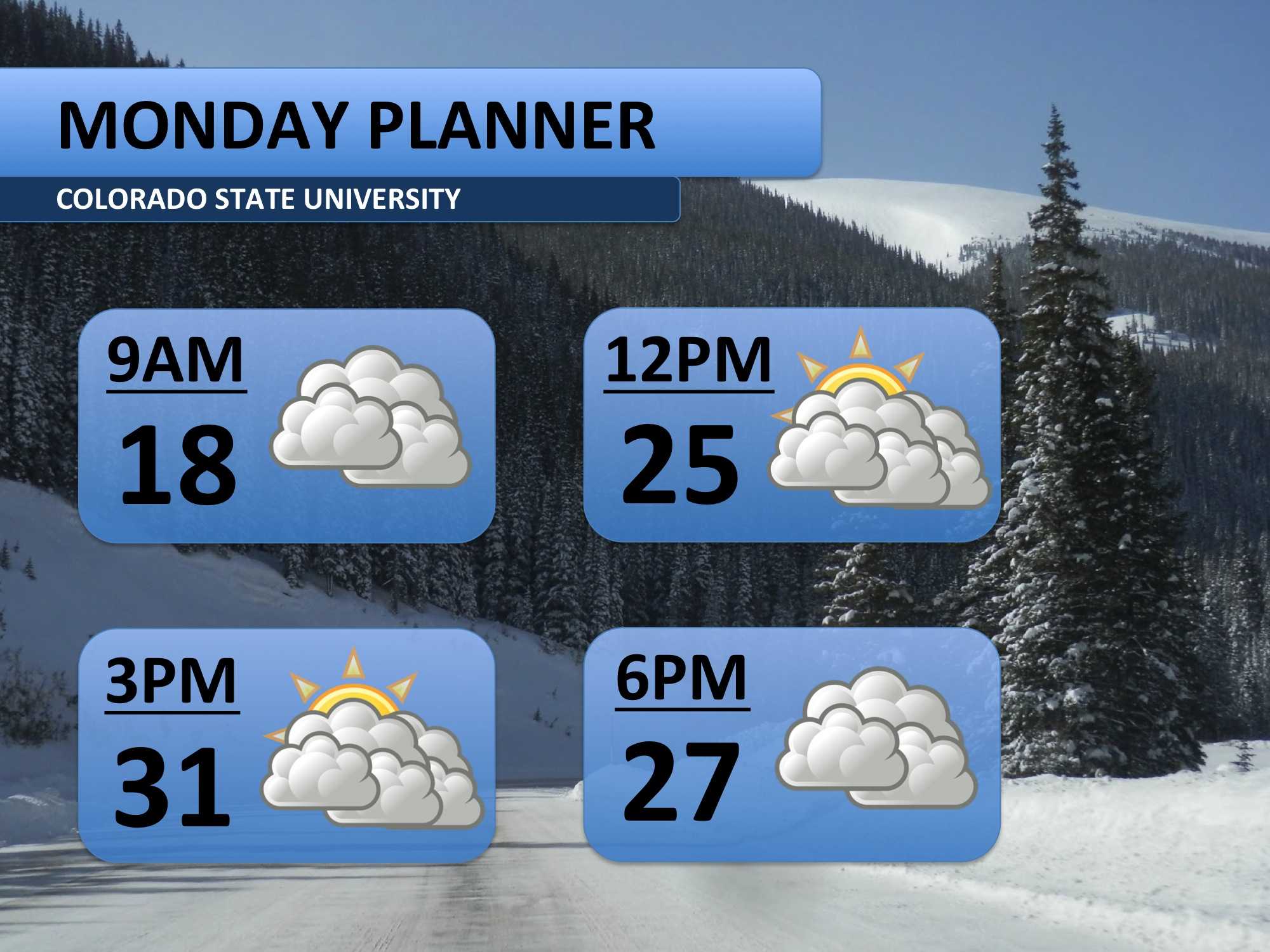
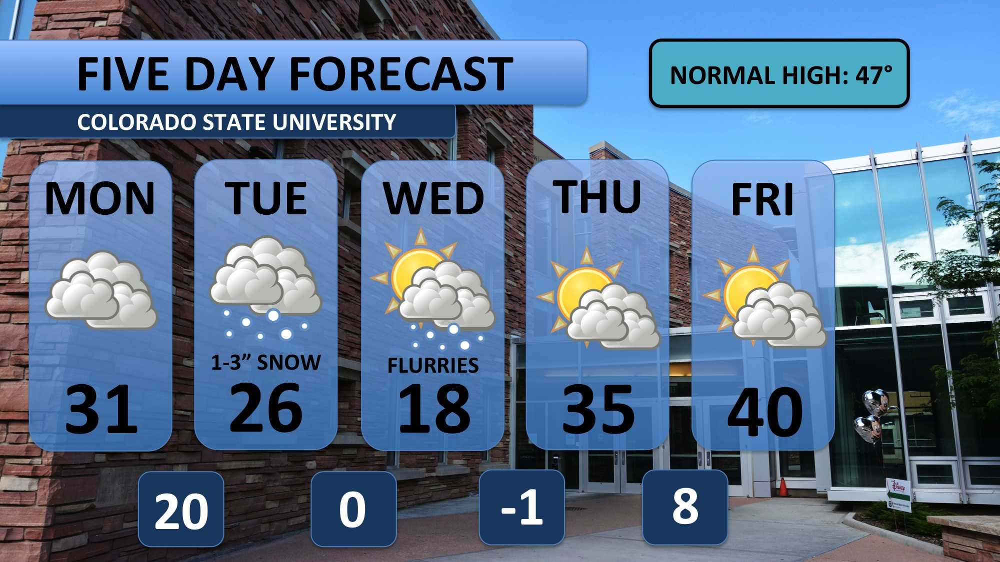
Just expect clouds Monday ahead of storm that arrives early Tuesday morning. Snow should fall for most of the day, and temperatures will plummet in the morning on Tuesday. So that high temperature of 26 will likely occur around 8:00am, and afternoon temps look to be in the teens.
Wednesday will also be frigid, but the sun should start to peek out in the afternoon. Thursday morning will be very cold. Thankfully, we warm up a bit towards the end of the week. Notice that we’ll still be below our seasonal average though.
Meteorologist Austin Harley can be reached on Twitter: @wx_harley.


