

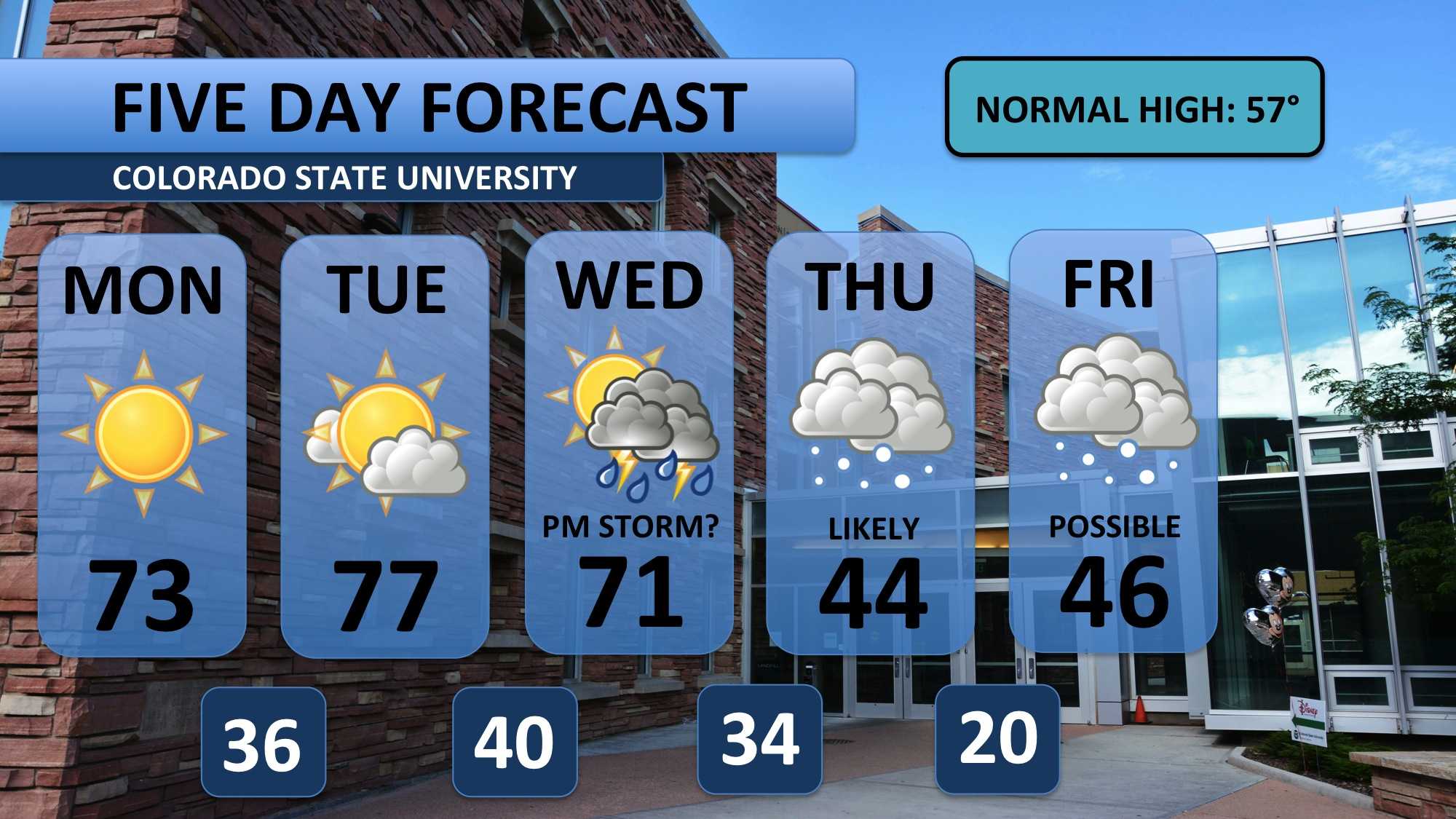
Temperatures were recorded breaking over the weekend — a high of 81 on Saturday beat the previous record by four degrees! Temperatures will surge back into the mid-70s on Monday. Don’t be fooled, these conditions are about 15-20 degrees above normal.

Lots of sun will begin the week, and temperatures will near 80 degrees again on Tuesday. Clouds will slowly build as we approach Wednesday — we’ll have enough moisture that afternoon to spark a few isolated thunderstorms. No guarantees we’ll see one in Fort Collins, but something to keep in mind.
Everything changes on Thursday. Temperatures drop 30 degrees and snow returns. After an abnormally dry March (our snowiest month), we’ll kick off April (the 2nd snowiest) with some accumulating snow. Weather models are still working to pin down the amounts. Keep an eye on the Collegian for updates!
Meteorologist Austin Harley can be reached on Twitter: @wx_harley.


