

Updated: Friday, 4:30pm
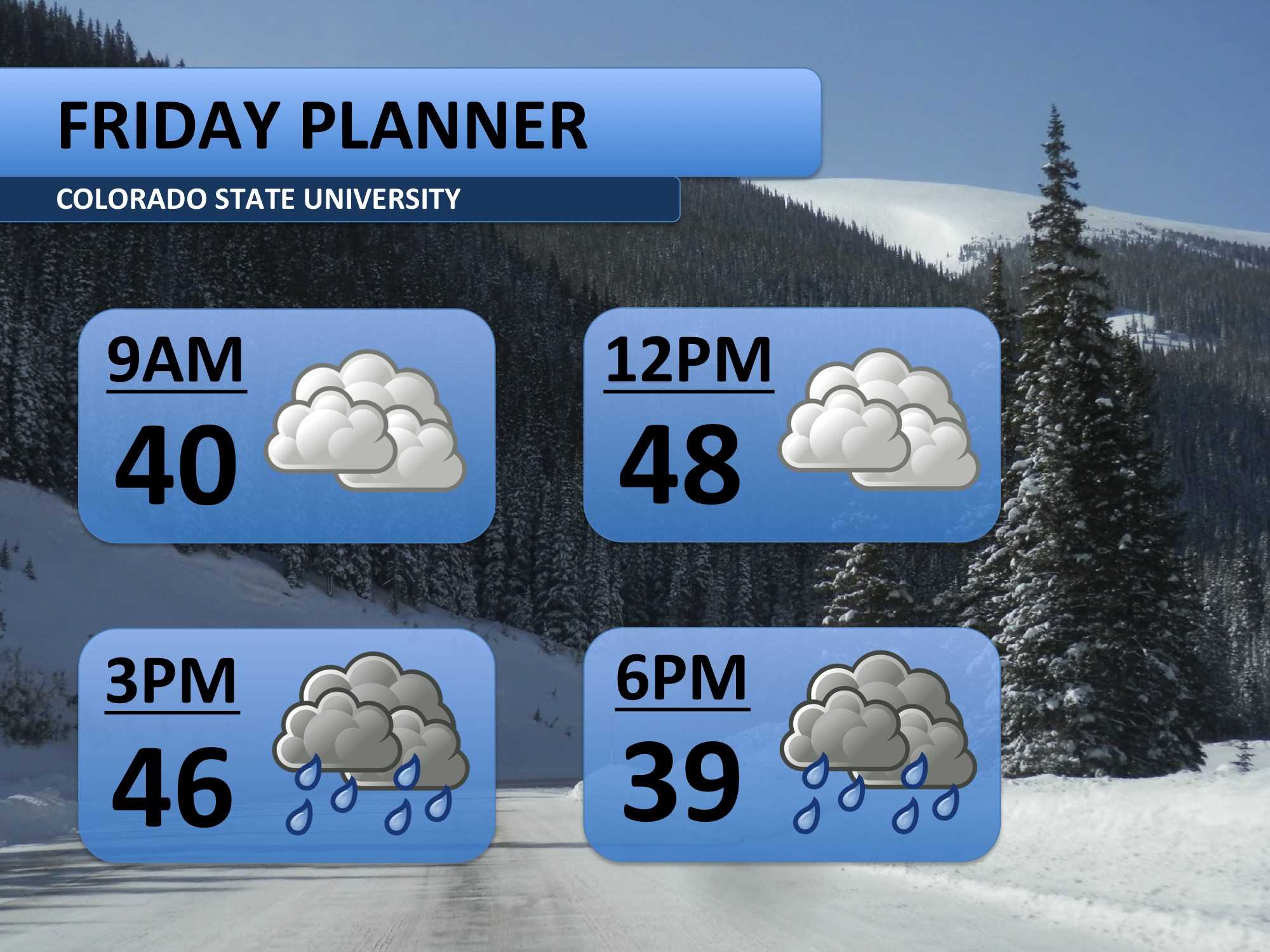
I’ve been advertising all week that some sort of winter weather was on the way for this weekend. Beginning today, the system will move into northern Colorado. Rain showers are possible through the afternoon. Temperatures should fall below freezing sometime around 10:00pm, which could ice up the roads. Be prepared to take it a little slower.
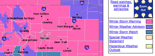
The National Weather Service in Boulder, CO has issued a Winter Storm Warning (pictured in pink) for most of northern Colorado. This means a major snowfall event is forecast to begin impacting the area soon. Travel across much of Colorado will be difficult this weekend, especially in the mountains.
My forecast for the duration of the event calls for six to twelve inches of snow in Fort Collins. Snow should begin falling late Friday night and will continue until early Monday morning. Ice could be a threat Friday night and Saturday morning. Continual snowfall will keep roads messy and plows busy for the entire weekend. You will definitely need to plan extra time for travel.

Finally, here’s a look at my five day forecast. Notice how the accumulations are spread out over the weekend. The snow won’t come all at once, but will pile up over time. The best opportunity for heavy snow will be Saturday afternoon and night. Otherwise, things should wrap up early Monday. Temperatures will get pretty cold on Sunday and Monday, especially the mornings when temperatures will be in the single digits. Skies clear and we warm up a bit on Tuesday and Wednesday.

Meteorologist Austin Harley can be reached on Twitter: @wx_harley.


