

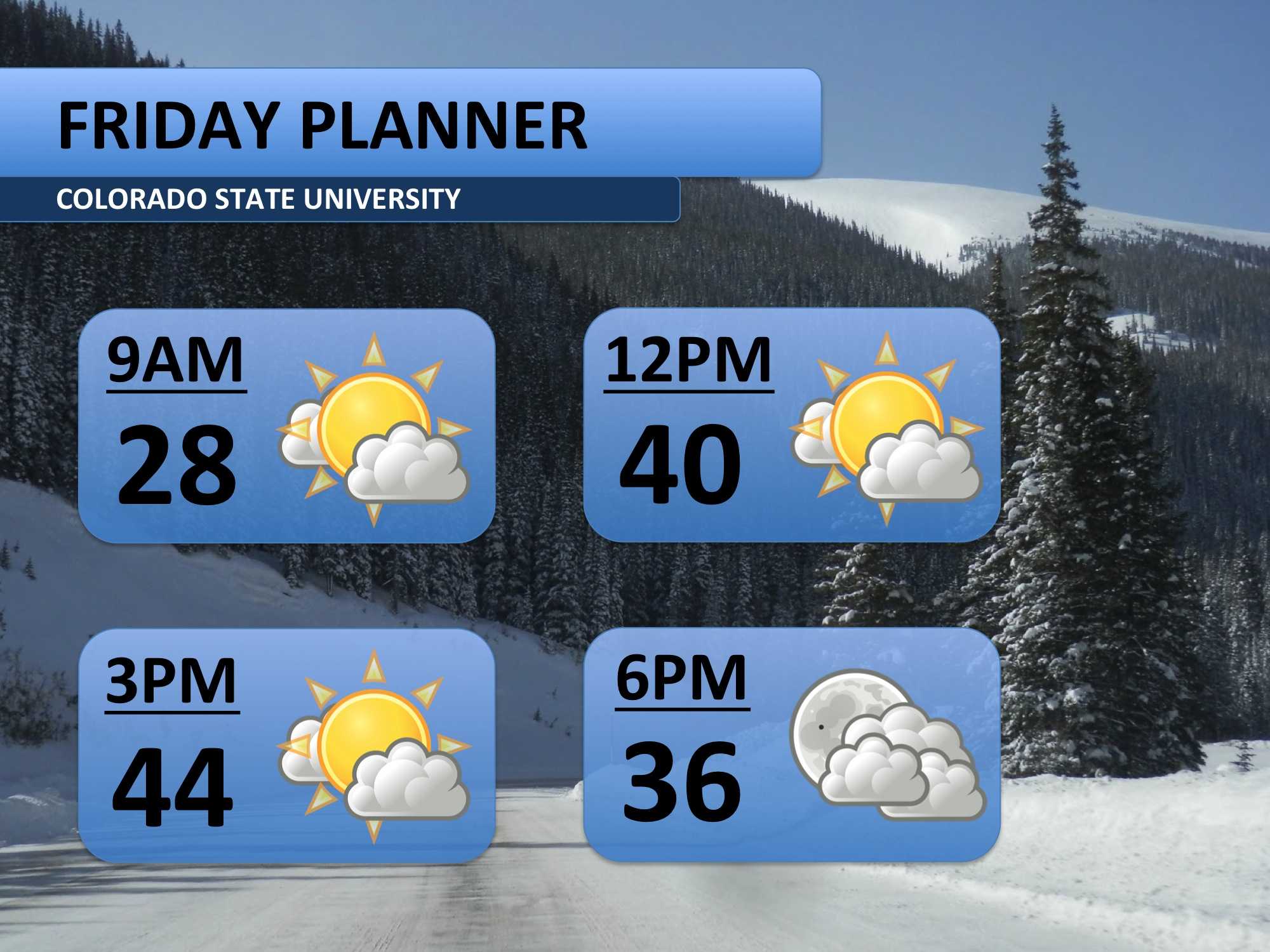
Conditions on Friday will mimic those we experienced on Thursday. Temperatures will remain in the 40s for most of the afternoon, and there should be plenty of sunshine. Bring warmer clothes along for any early morning finals.
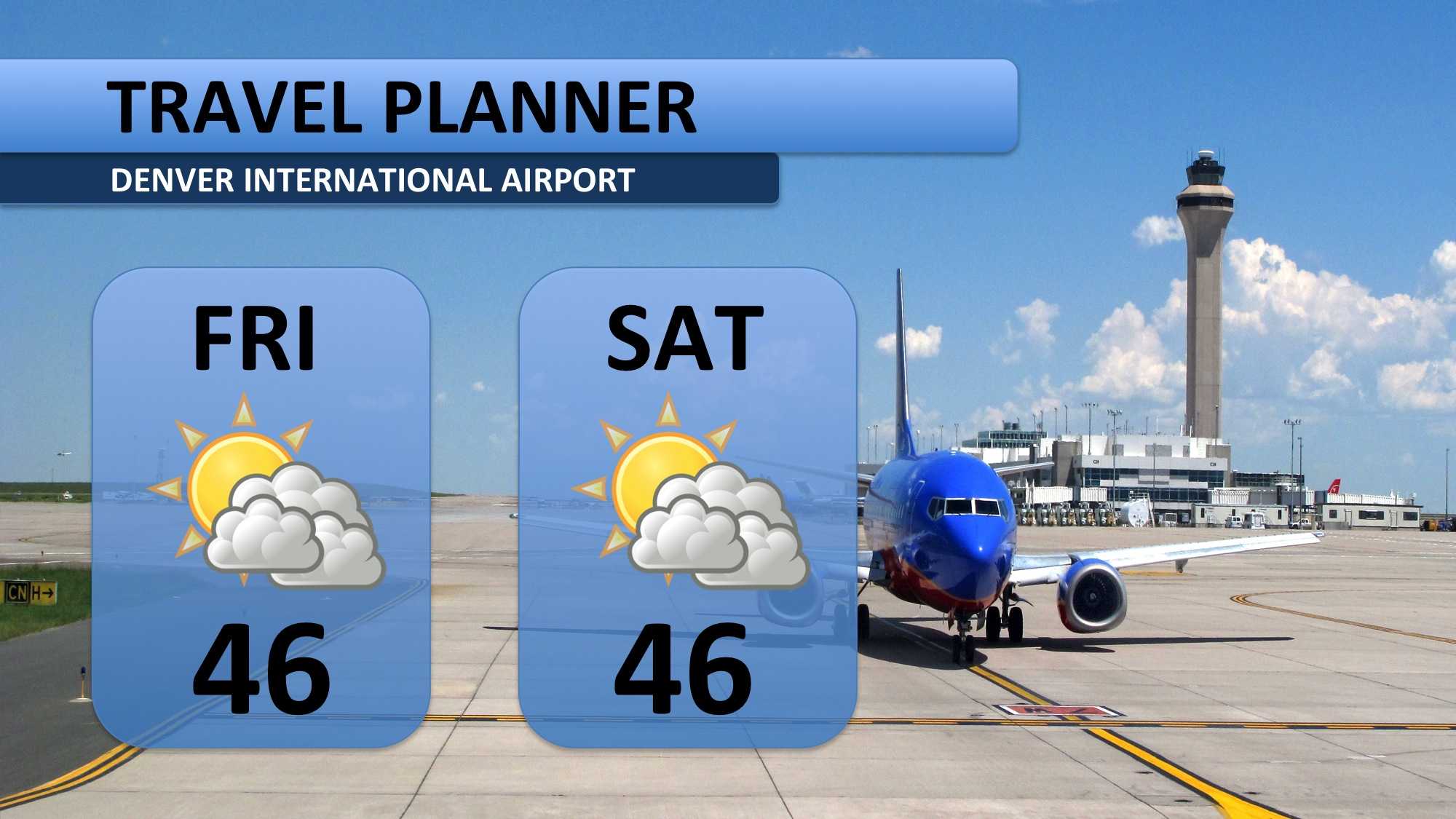
Today and tomorrow are both forecast to be good days for travel along the front range. If your plans take you to Loveland, Denver, Colorado Springs or Pueblo, then expect dry roads and seasonal temperatures.
For those planning to fly, check out the planner below. DIA shouldn’t experience any weather-related delays. Thunderstorms are in the forecast for Louisiana and Texas, so check ahead if you’re headed there. Snow-related delays could be possible around the Pacific Northwest as well.
The weekend should be fairly mild for December. Sunday will climb into the low 50s before a cold front arrives early Monday morning. Weather models continue to struggle with much of next week’s weather forecast. Monday could see anywhere from one to six inches of snow.
Another winter weather system is forecast to arrive Thursday night, and it again could produce a wide variety of snow totals. One thing is certain though, the mountains are going to get a good dose of powder. One to two feet looks likely for much of the high country throughout next week.

This is the last weather blog of the fall semester. The next forecast will be produced on Monday, January 19th. Have a great winter break!
Meteorologist Austin Harley can be reached on Twitter: @wx_harley.


