

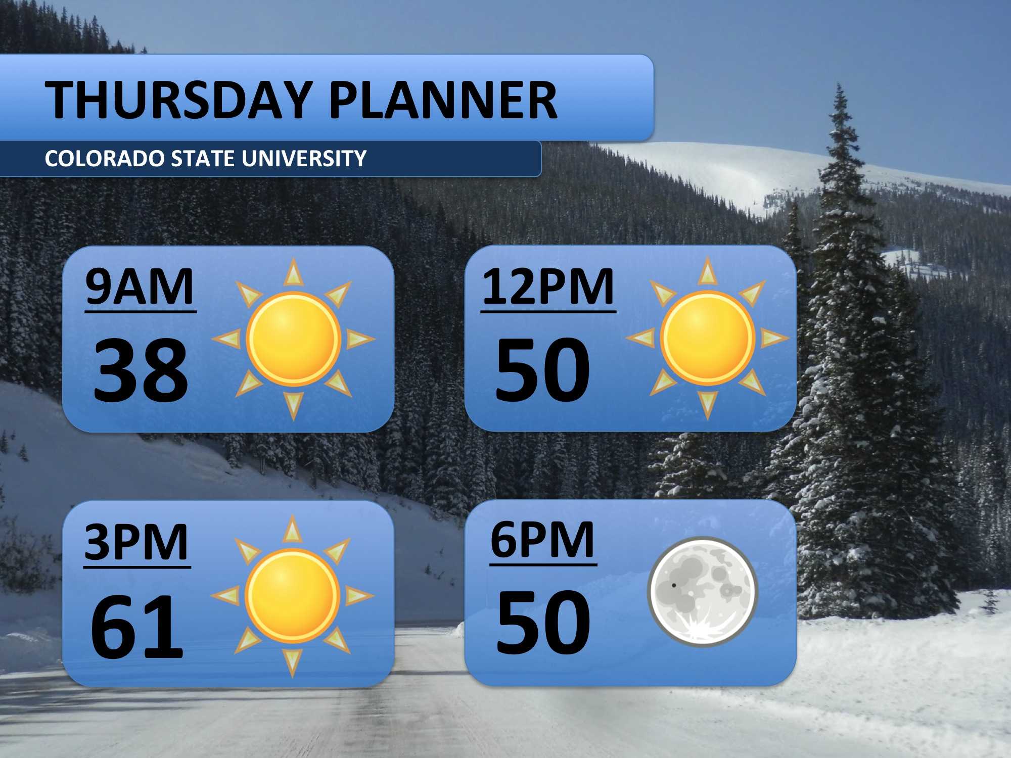
The low 60s we had on Wednesday should repeat on Thursday. Feel out of season? Well, it is. These temperatures are more reminiscent of mid-October, not mid-December. There will be plenty of sunshine throughout the entire day too. Get out and enjoy the weather, we all know it won’t last!
Warm, mild weather continues through Friday and into the first half of the weekend. Although it’s unseasonably warm, we’ve experienced hotter weather in the past. The only record high temperature we come close to would be Saturday’s record of 66 (set in 2010).
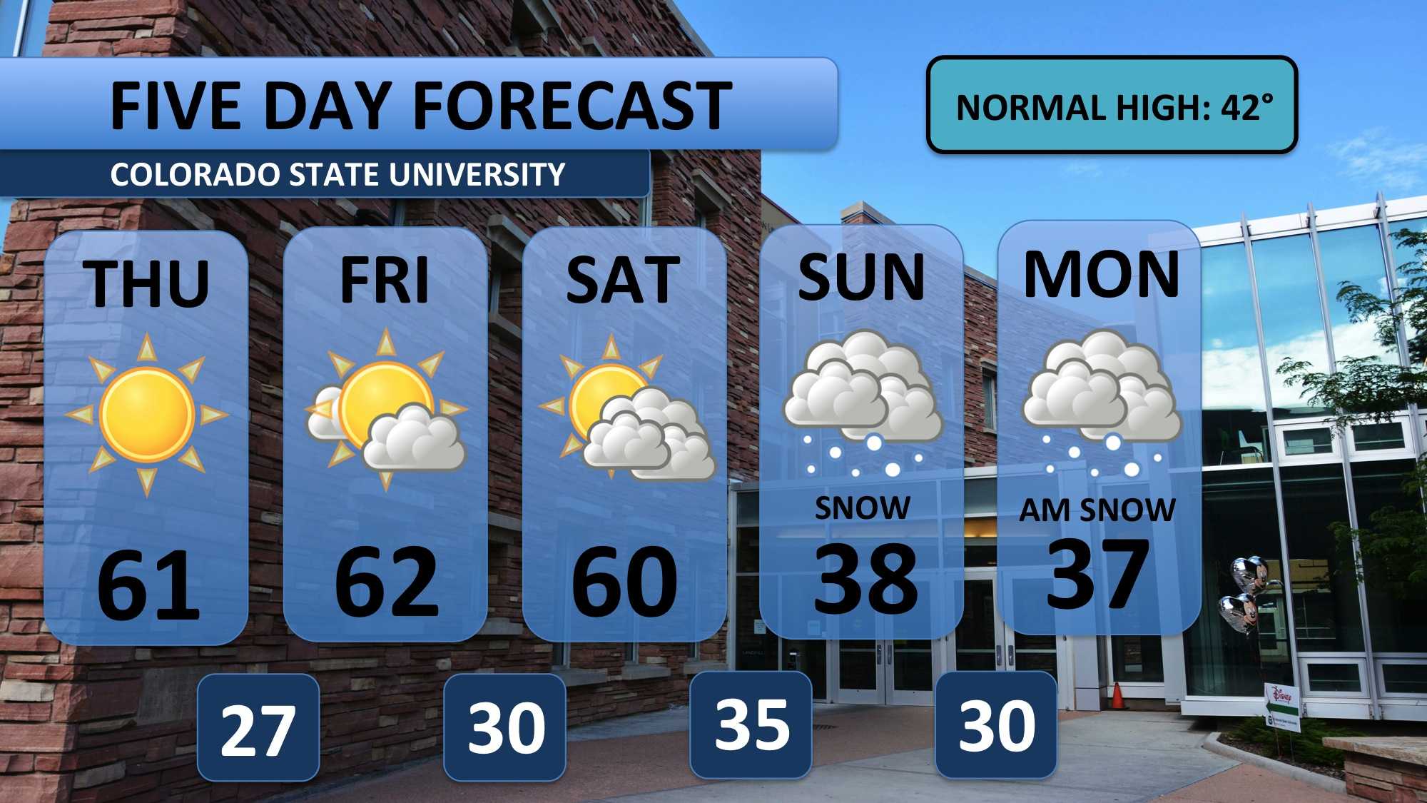
Now, turn your attention to Sunday and Monday. A winter storm system is expected to set up over southern Colorado. Although some uncertainty remains, it is likely that Fort Collins will see at least a few inches of accumulating snow. Areas south and east of Denver have been pegged as the most likely to see heavy snowfall. Sunday night and early Monday morning should bring the bulk of the snow.

Don’t get ready for a warm-up next week. After the snow ends on Monday, temperatures are forecast to stay in the 30s for the rest of finals week.
Meteorologist Austin Harley can be reached on Twitter: @wx_harley.


