

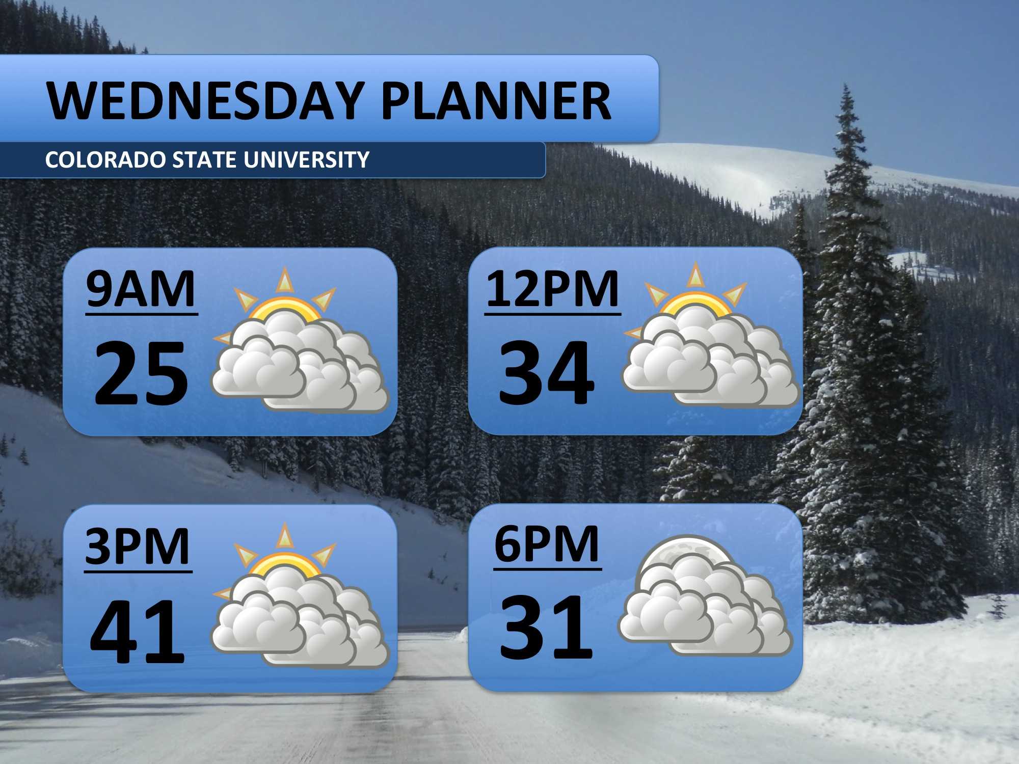
December, overall, has been a fairly warm month with temperatures running about seven degrees above normal. A weak brush of cool air, however, will keep temperatures in the 30s and 40s on Wednesday. Flurries were expected for this evening, but the chance has decreased so much that I had to pull it out of the forecast. I’m just going with clouds for today.
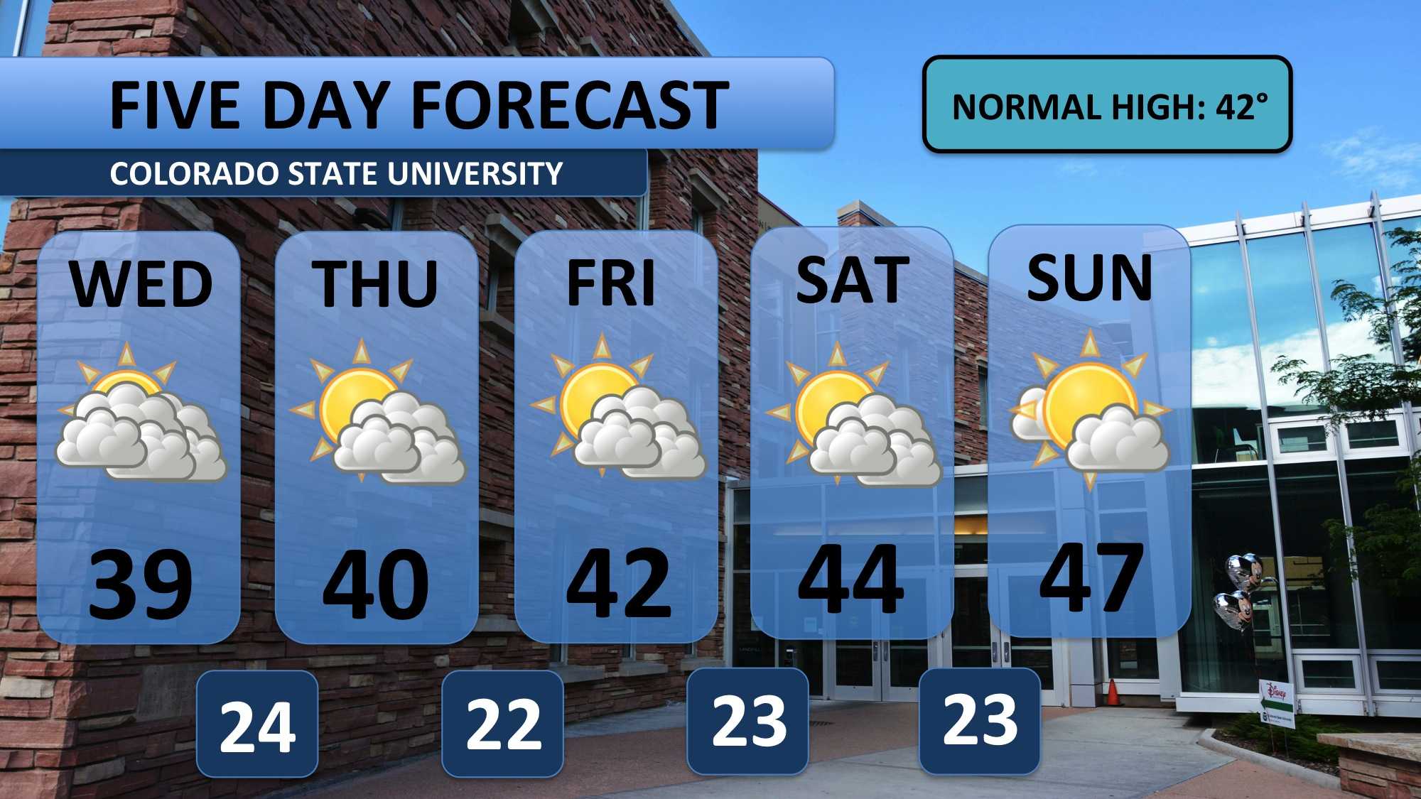
Different weather systems will impact mountain regions and ski resorts throughout the next few days, but conditions are expected to moderate along the front range. Mid 40s and sunnier skies are forecast for the weekend. Overall, it looks like weather across eastern Colorado should favor travel conditions.
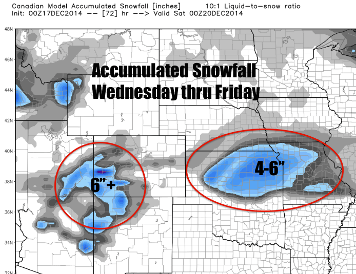
Although local weather appears okay for travel, some snow is expected regionally. Below is a picture of one weather model’s snow forecast through Friday evening. About six inches of snow is predicted to fall Wednesday night and Thursday morning across a good portion of Kansas.
Elsewhere, snow will slowly pile up east of the Continental Divide in Colorado through the next three days. Those headed to southwestern Colorado may need extra time for their drives.
Meteorologist Austin Harley can be reached on Twitter: @wx_harley.


