

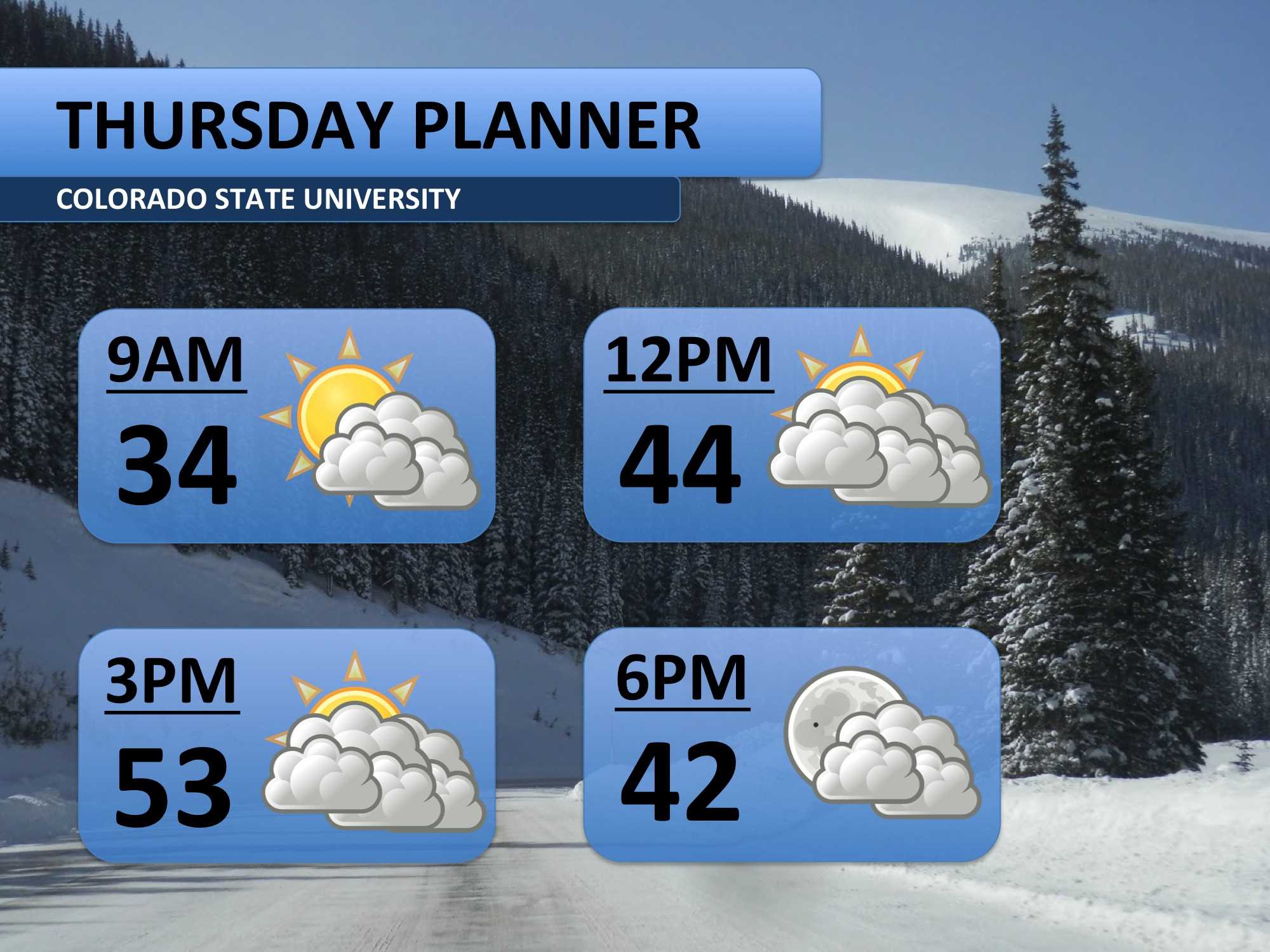
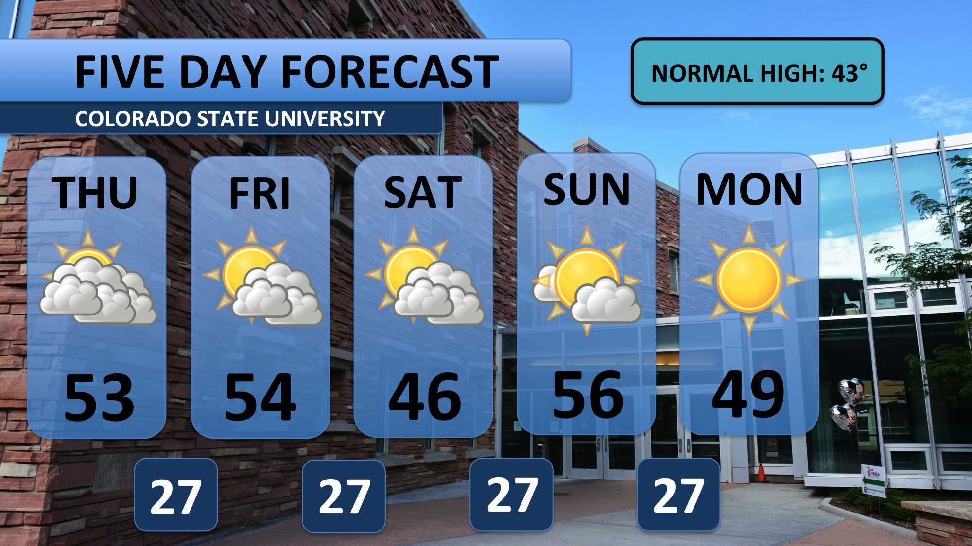
Thursday marks the beginning of an extended period of above average temperatures. Winds will be light and from the west. Combine this with some upper-level moisture, and we should end up with quite a bit of cloud cover through the afternoon. Temperatures should still climb into the low 50s though.
Similar conditions will prevail on Friday before a weak cold front drops temperatures into the middle 40s on Saturday. Sunday is forecast to be an absolutely beautiful day, so make your plans for that day! Monday and Tuesday next week should bring the arrival of pretty dry air and blue skies.
Overall, the next two weeks look to be relatively dry and warm. Long-range weather models don’t bring cooler weather back to the front range until the latter part of finals week. That could certainly change, and we’ll keep you up to date on that!
Meteorologist Austin Harley can be reached on Twitter: @wx_harley.


