

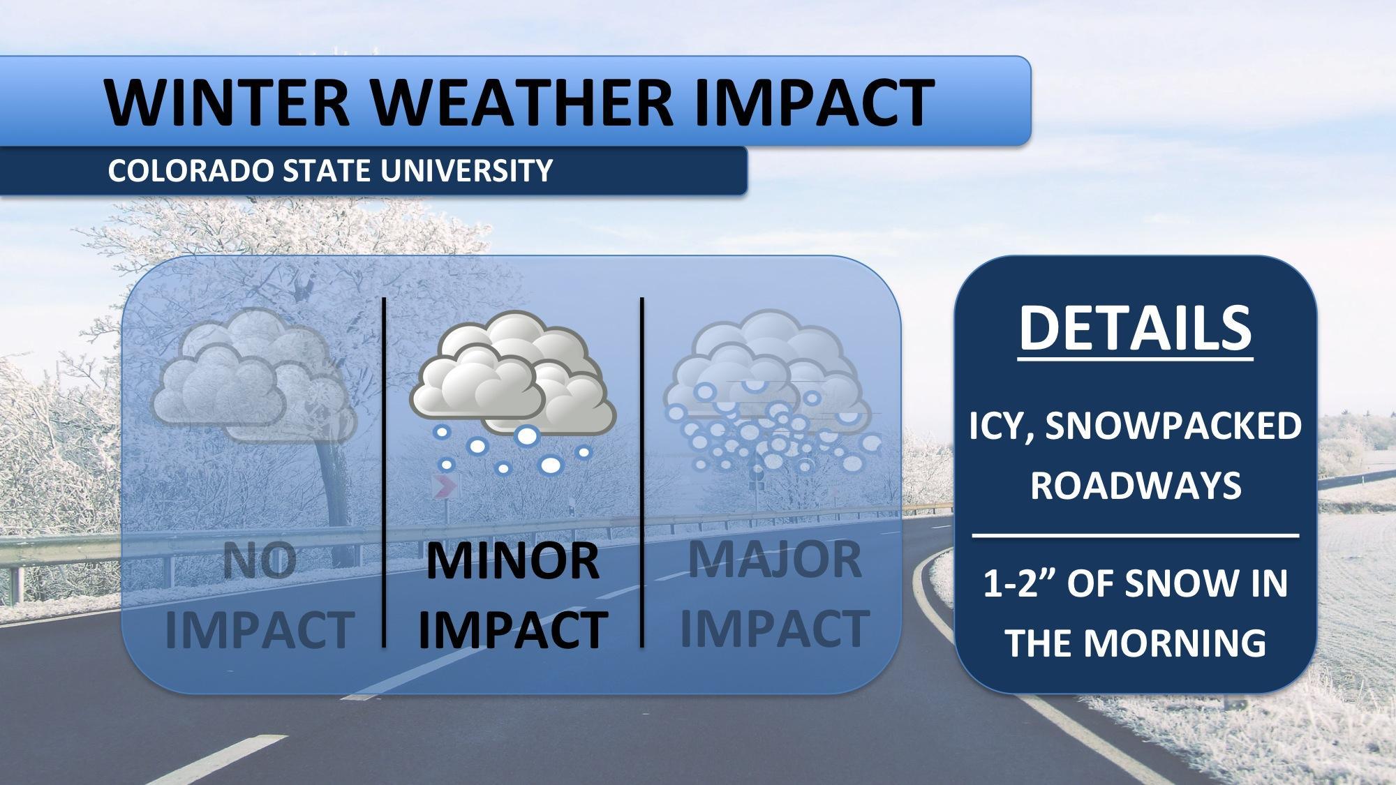
The coldest high temperature ever recorded for November 12th (today) was nine degrees. You’ll notice below, the forecasted high for today is seven degrees. So, we’re looking at a historically cold day. A wind chill advisory was in effect overnight as temperatures felt more like -15 degrees. Wind chills today will again be dangerously cold. Limit your time outdoors. An additional 1-2″ of snow is expected before noon, after which it should taper off.

Fort Collins plows and CDOT have been working hard to keep the roads clear and ice free, but they are focusing on main thoroughfares. Side streets, as you may have noticed yesterday, are snow packed and icy. Allow extra time for your drive on Wednesday, and bring along the cold weather gear!
After single digit temperatures on Wednesday, we may be able to just barely make it to 11 degrees tomorrow. Not much snow is expected on Thursday, mainly sporadic flurries. Fort Collins is expected to climb above freezing and stay dry for Friday. Enjoy the relative break, as another bout of cold air arrives Saturday. Temperatures will again fall into the teens and more accumulating snow is forecast. Cold air sticks around all weekend.
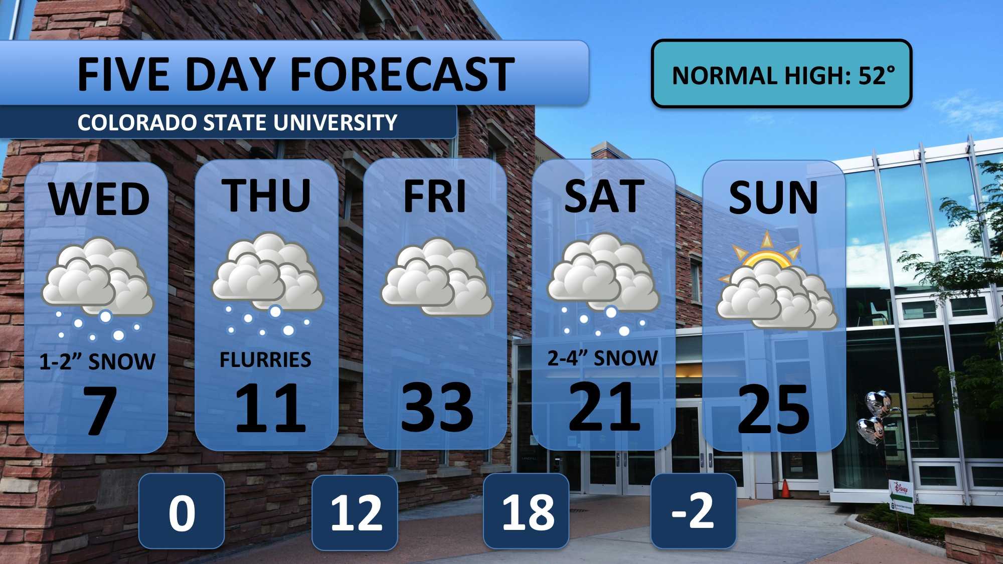
Temperatures will continue to be 30 to 40 degrees BELOW normal for the next ten days.
Meteorologist Austin Harley can be reached on Twitter: @wx_harley.


