

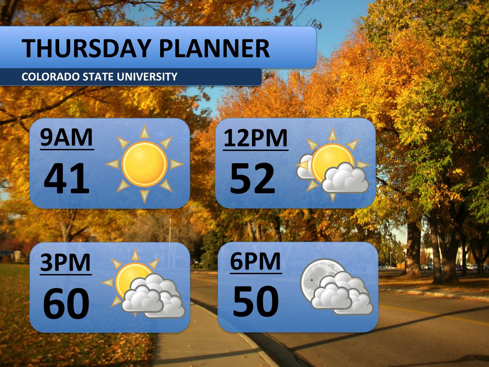
Heading into your Thursday, the weather will remain similar to what it was on Wednesday. Temperatures will climb just a few degrees higher, peaking around 60 degrees. Neither wind nor rain will be a problem today. Plan on brining a sweatshirt or jacket.
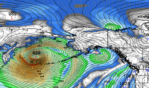
While the lower 48 enjoy some milder weather, an extremely strong storm is brewing in the Pacific. It is set to impact Alaska’s Aleutian Islands and the Bering Sea on Friday. The weather system, a combination of a tropical and winter storm, could be one of the strongest non-tropical storms ever recorded. Waves up to 50 feet and winds over 75 miles per hour are possible. Despite the storm’s distance from Colorado, it will cause a significant shift in our weather pattern next week. Below is a rendering of one weather model’s wind speed prediction for the storm.
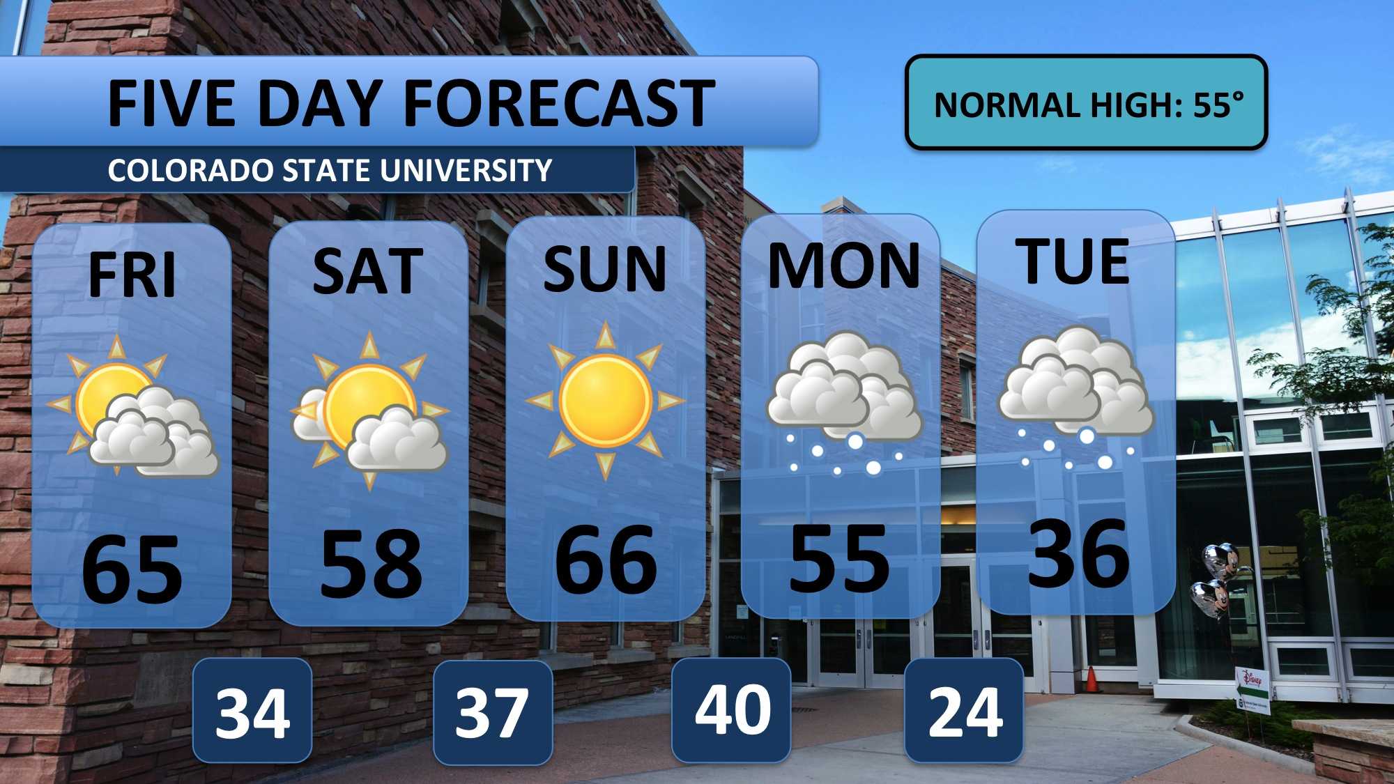
A warm, dry weather pattern will continue to dominate the western United States and Colorado through the next four days. A weak front will drop temperatures a bit on Saturday, but nothing really significant. Sunday looks like the choice day for outdoor activities this coming weekend. Energy from the major Alaskan storm will force polar air southward next week. Some models have this cold air arriving in Fort Collins on Monday; others have the cool down on Tuesday. Either way, it is going to come in fast and strong. The cold air looks to hang around for most of next week too. Snow forecasts are all over the place, but I’ll go with snow for Monday afternoon/evening and Tuesday. It’s too soon to say how much snow to expect, but over an inch looks likely.
There’s lots more to come throughout the next few days. Stay tuned for updates!
Meteorologist Austin Harley can be reached on Twitter: @wx_harley.


