

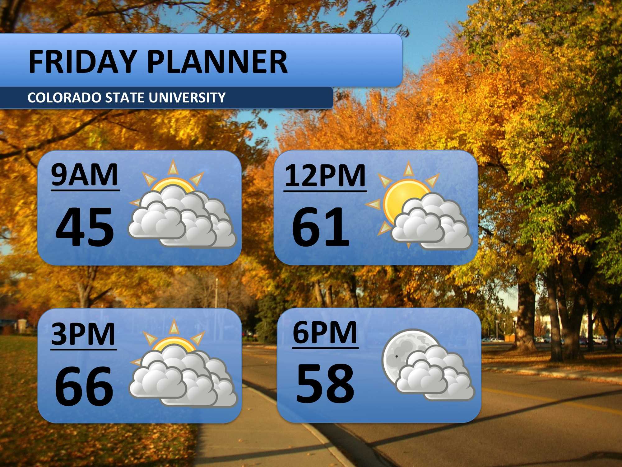
Friday will be yet another nice day! Temperatures will climb at least ten degrees above normal, peaking in the middle 60s. It’s going to be one of those typical Colorado days: sweatshirt in the morning, t-shirt in the afternoon. We may get a nice wave cloud set up this afternoon, which would cover most of the front range. It should clear out by the evening.
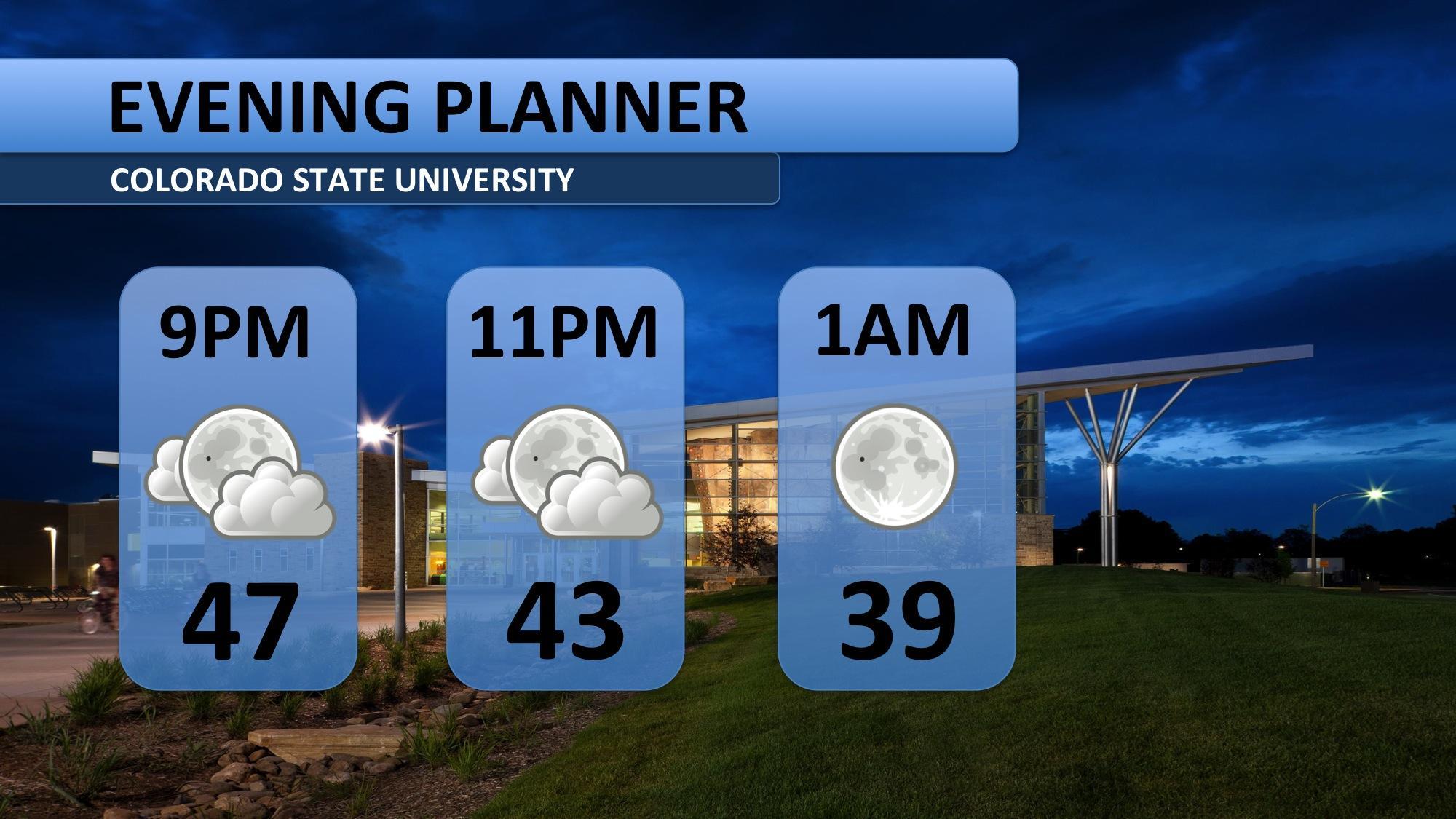
Friday evening will be fairly mild for this time of year. Temperatures will be in the 40s through about midnight. Bring a jacket along. The full moon peaked Thursday night, but it’ll still be shining bright tonight! The clouds should be few and far between.
Saturday will be fairly mild with mostly sunny skies. The Colorado State vs. Hawaii game will be dry with mid-50s for kickoff. Sunday will warm a bit and still have plenty of sunshine. Monday will mark a major change to the forecast…
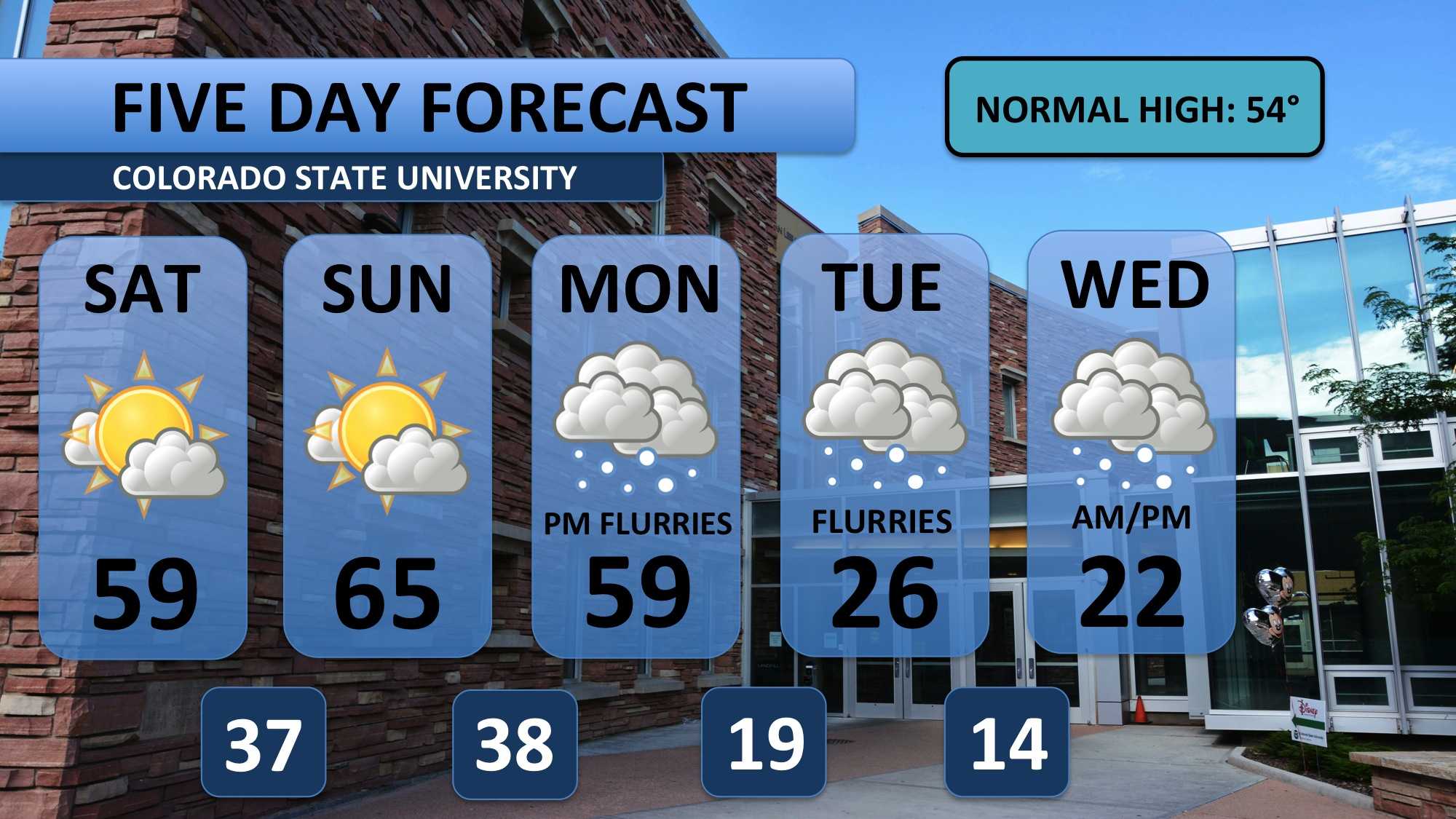
Conditions, for the most part, have been warmer than normal for the past few weeks. Whether you like it or not, a significant cool down is on the way. An extremely strong storm near Alaska will force cold Canadian air southward into the US next week.
Temperatures will plummet behind a cold front expected to arrive Monday evening. A few flurries may accompany this front. Tuesday will be in the 20s throughout the entire day, and wind chill will have it feeling about ten degrees cooler than that. A few flurries are expected after sunset.
Wednesday is expected to be nothing short of frigid. It brings the best chance for any significant snowfall. A couple inches are possible through Wednesday, but that could certainly change in the coming days. We’ll keep you updated.
Weather models agree that this cold air will stubbornly stick around through Thursday, Friday and next weekend. Watch for more details in Monday’s Collegian and on social media!
Meteorologist Austin Harley can be reached on Twitter: @wx_harley.


