

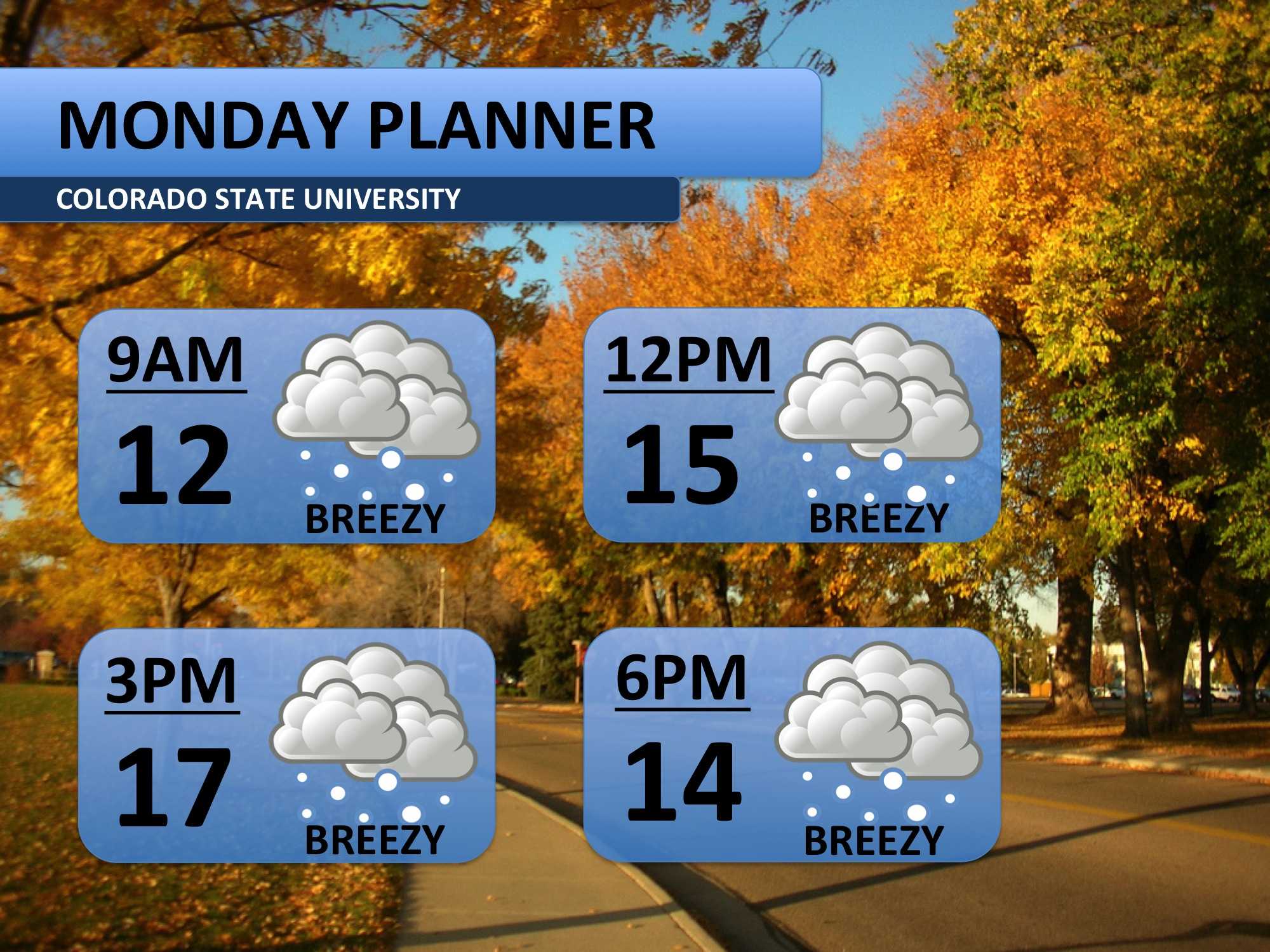
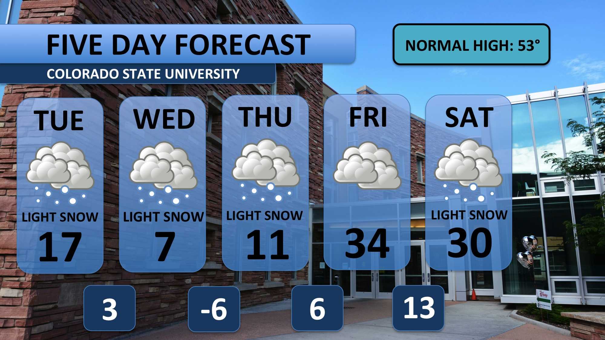
Behind a strong, fast-moving cold front on Monday, temperatures dove and snow fell. Not much will change on Tuesday. In fact, expect even colder weather with temperatures in the teens throughout the day. Single digit wind chills will be common. Light snow all day and into the evening as well. Expect about two inches on top of what fell early Tuesday morning.
This mass of cold air that arrived yesterday will be sticking with us for quite an extended period of time. Wednesday is one of the coldest days in the forecast – nearly 45 degrees below average. Some weather models indicate that this cold a “one in a hundred year event.” An inch or two of snow is forecast for Wednesday. Another inch should fall Thursday as temperatures continue to be very cold. Friday looks dry at this time and will be the only day for awhile that climbs above freezing. Another round of frigid air will pull temperatures back down on Sunday and Monday. Stay warm!
Meteorologist Austin Harley can be reached on Twitter: @wx_harley.


