

Monday morning may be the last day for at least a week that temperatures climb above freezing. Winds will be quite gusty throughout the day, up to 30 miles per hour. A strong cold front is expected to arrive sometime around noon on Monday. Rain will begin around the same time, and as temperatures fall, it will transition to snow. Rain and melted snow may ice over late in the afternoon. Drive carefully!
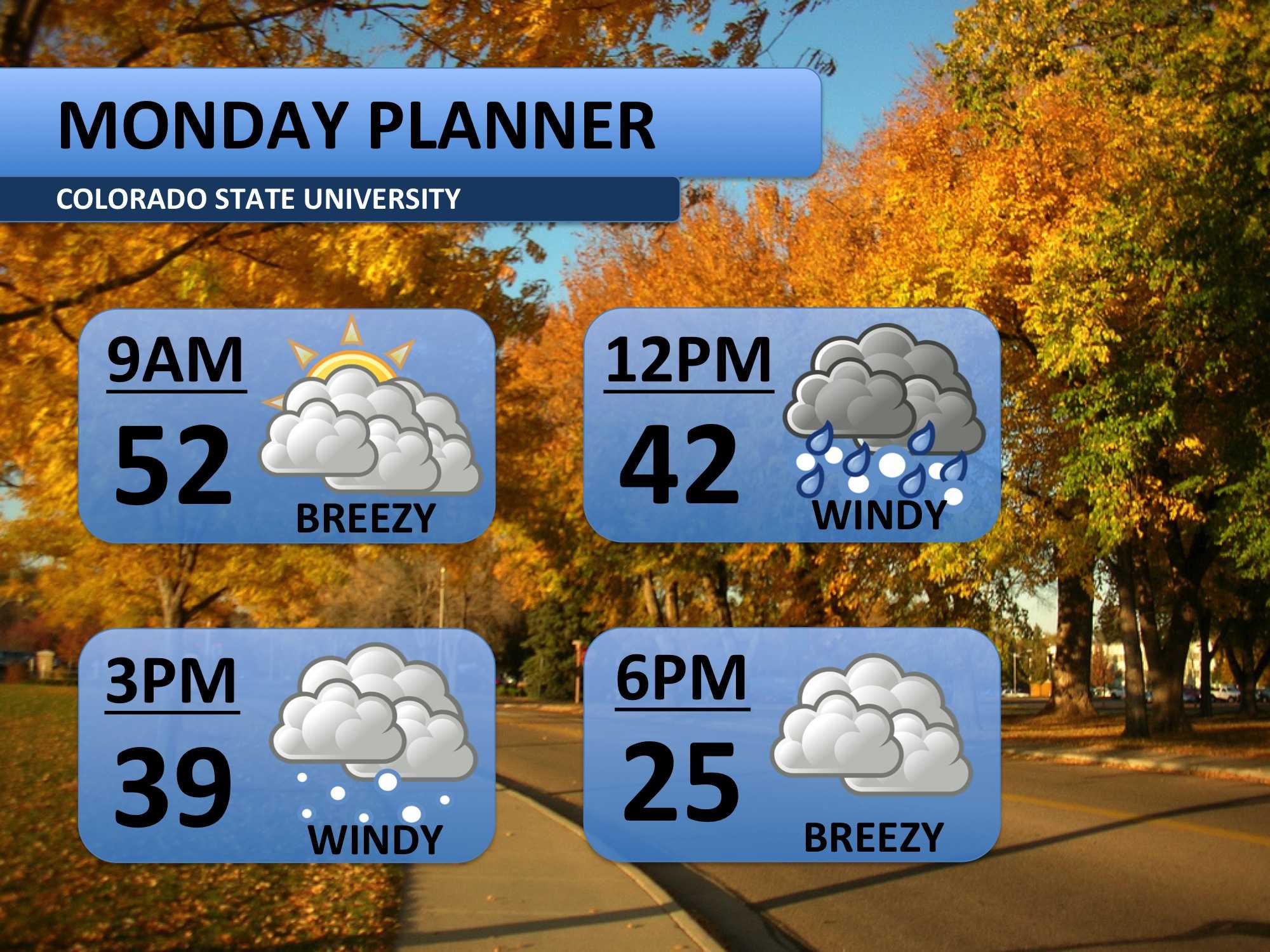
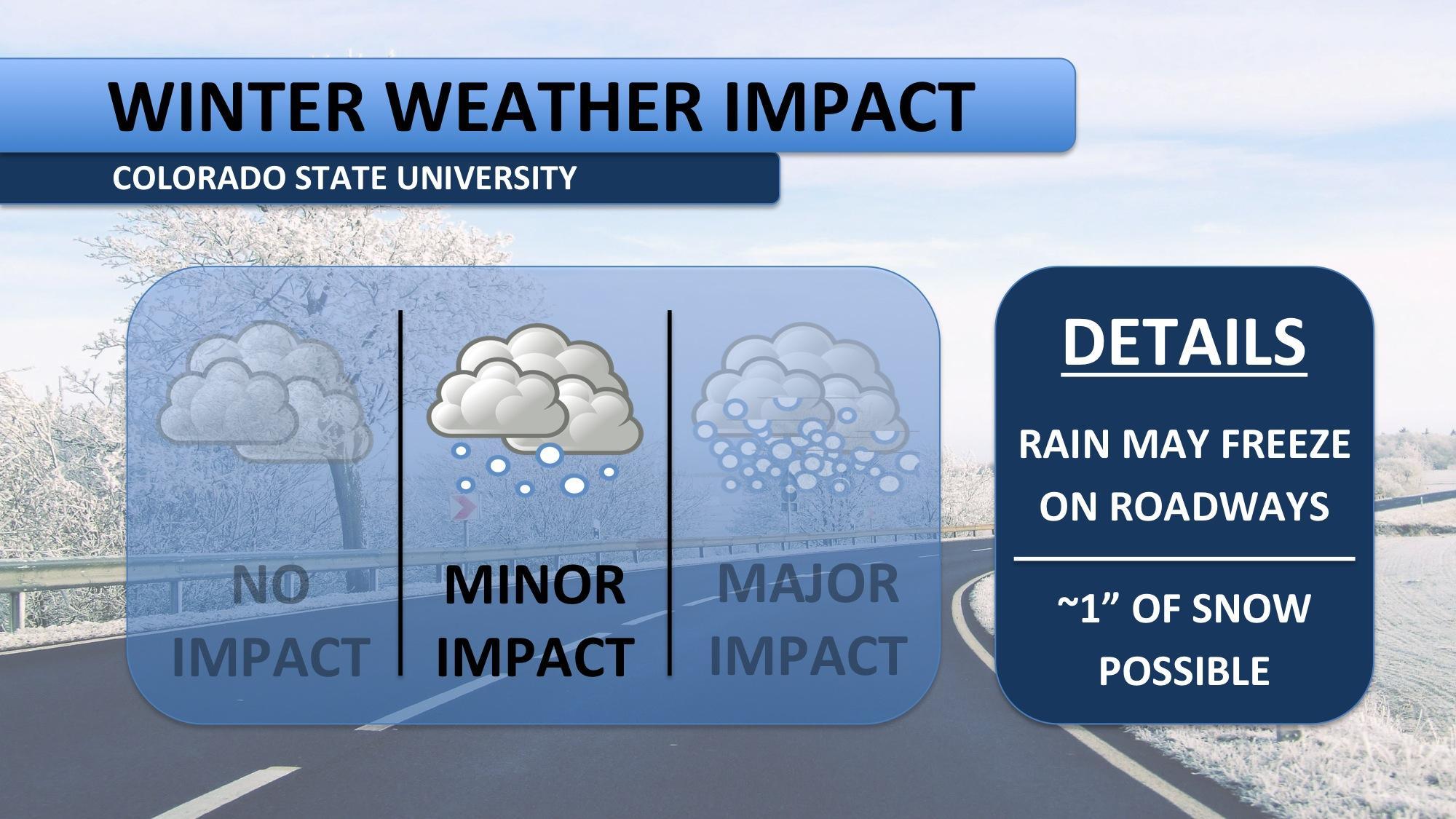
Not a lot of snow is forecast for Monday, less than an inch. The major worry is ice. Temperatures will fall below freezing around 5:00pm, and as that happens, ice may form. Roadways and bridges may become slick. The morning commute will be fine, but expect a few delays into the evening and overnight hours.
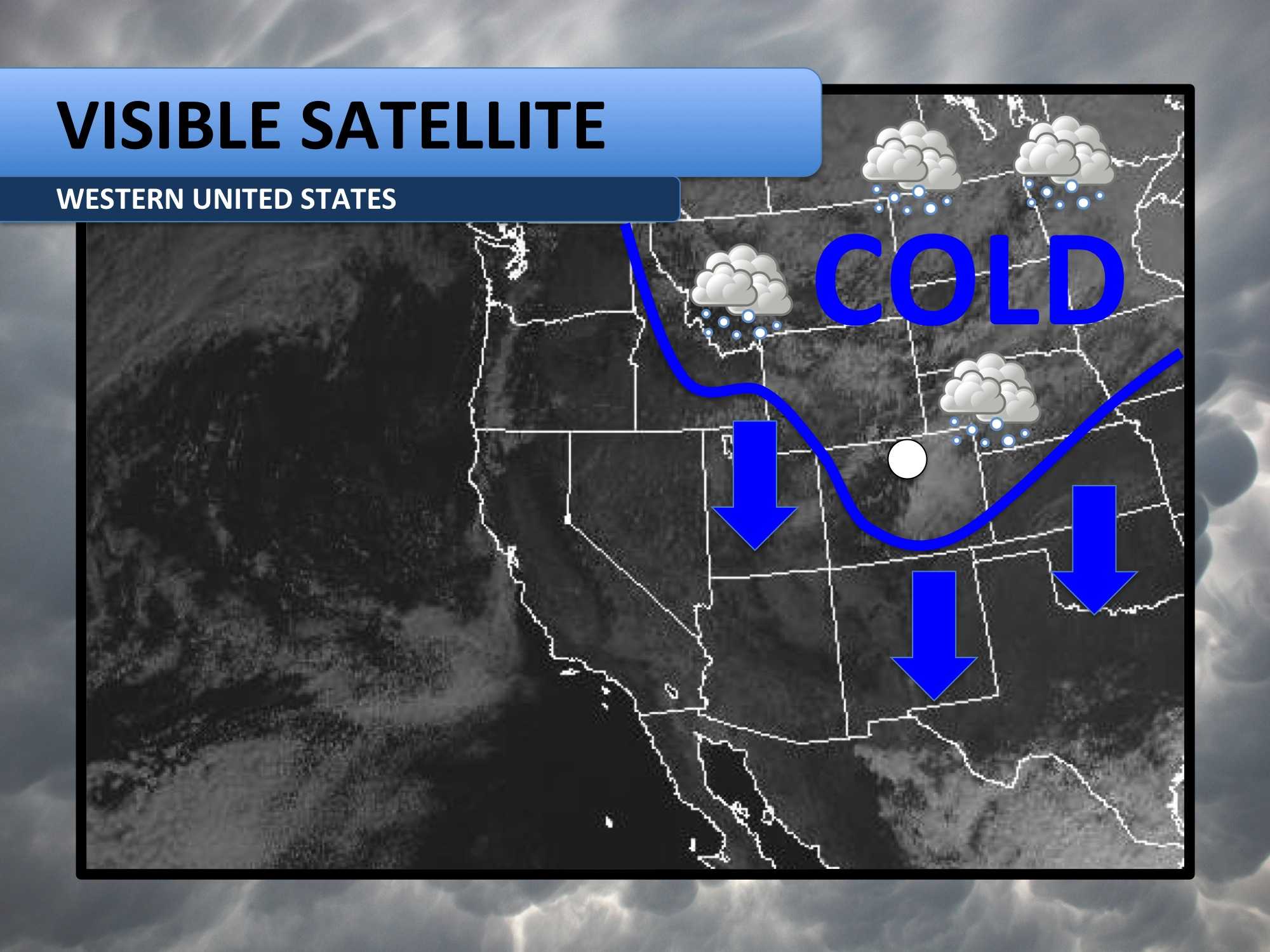
Strong Arctic air will flood into a majority of the United States on Monday. It will continue to advance south and get colder over the next week. This weather system will bring some snowfall along with it, but not major events are expected for Fort Collins. The highlight of this event will be the unseasonably cold weather. In fact, some models indicate that Wednesday temperatures only occur about once every hundred years!
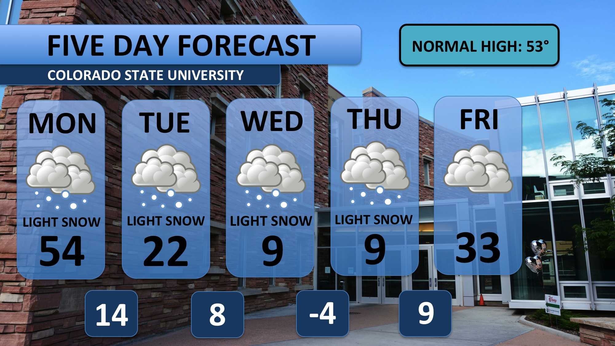
A high of 54 degrees will peak Monday morning before rain and snow fall into the evening. Tuesday will only top off in the low 20s as the weather system strengthens. For the mid-week, temperatures will spend a majority of the time in single digits. Two to three inches of snow are possible on Wednesday and Thursday. Friday will bring relief from the snow, and temperatures will return to the 20s. Don’t get too excited though, another round of cold air arrives for the weekend.
Bundle up!
Meteorologist Austin Harley can be reached on Twitter: @wx_harley.


