

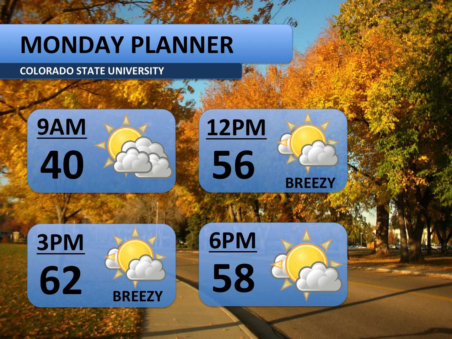
After a cool Sunday, temperatures will return to seasonal norms on Monday. Some cloud cover and cool temperatures Monday morning will give way to a sunnier afternoon. A bit of breeze will pick up through the afternoon. Today’s forecast is about as average as you can get for this time of year!
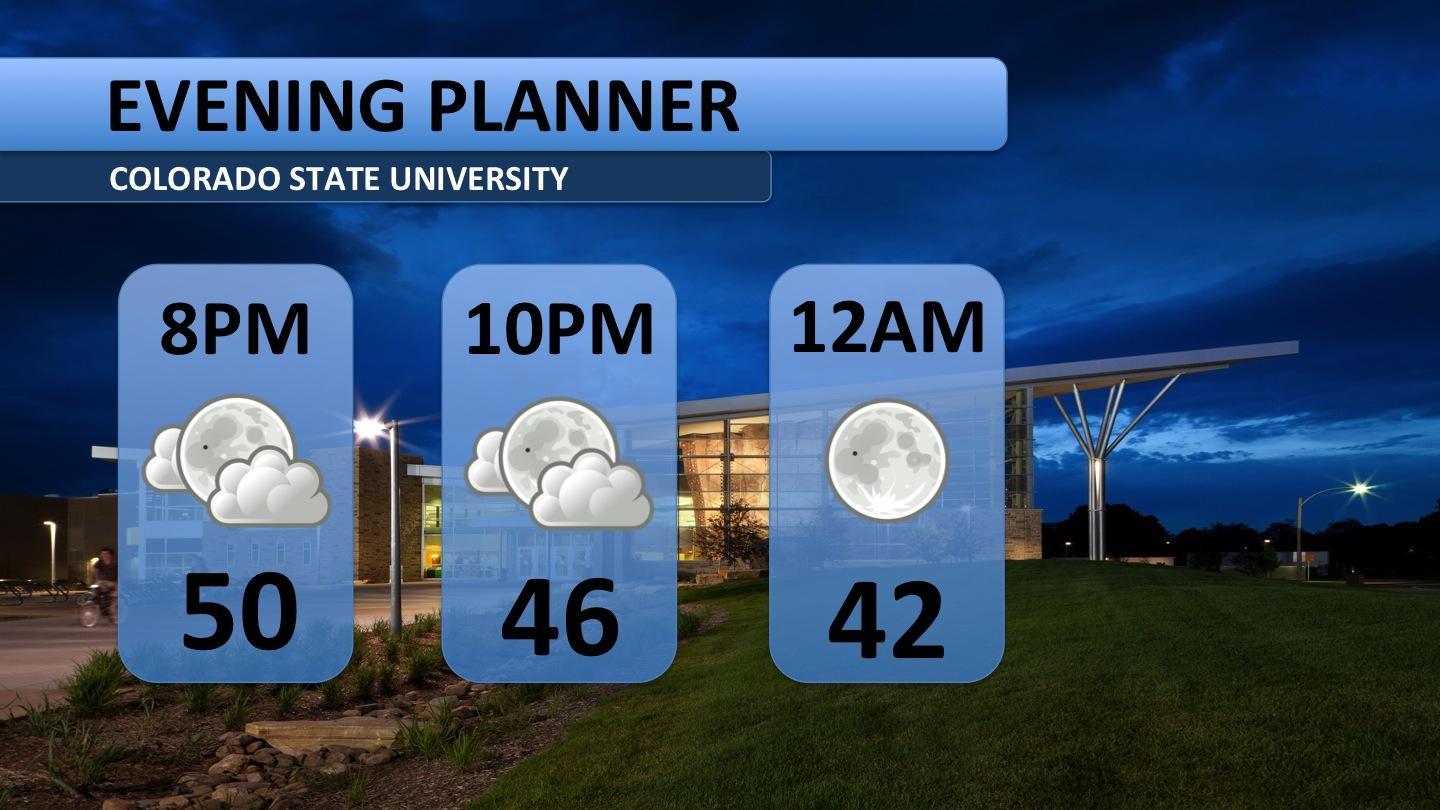
It’ll be fairly cool again Monday night. Bring a jacket along. Skies will slowly clear toward midnight, so if you’re interested in some stargazing, head out tonight!
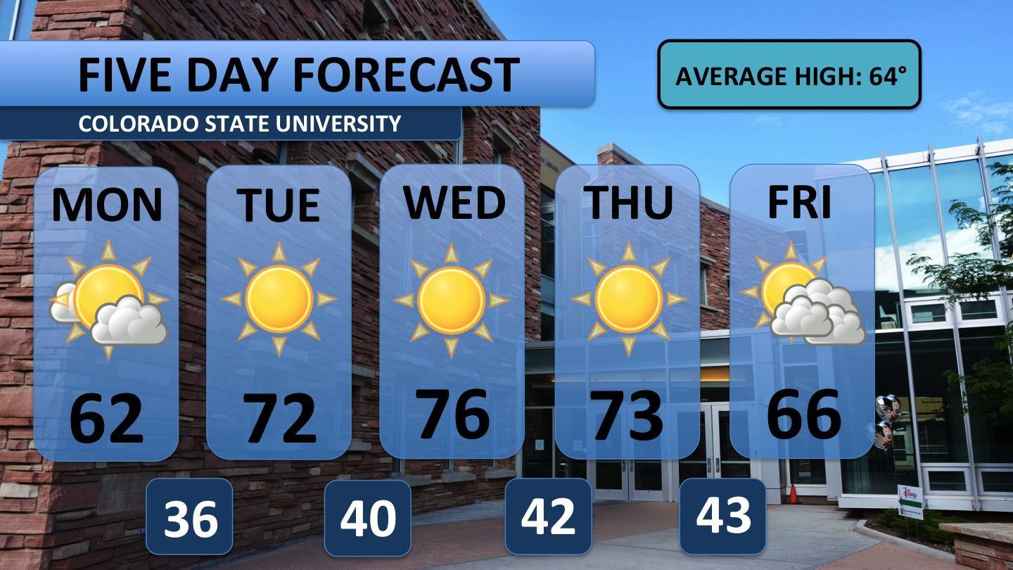
Although Monday will be average, the middle of the week will climb nearly ten degrees above normal. Upper-level high pressure will also cut off any chance of precipitation. The only significant weather event forecast for the next five days comes Thursday evening. A cold front is expected to push through the area then. It will cool temperatures for Friday, bring a few more clouds, but no rain is expected at this time.
Curious about the arrival of winter? Here’s a quick update on what’s to come:

Enjoy the warmer weather. Snow is NOT forecast in the next ten days. Upper-level high pressure will dominate the area for a majority of the next two weeks. The best chance of snow won’t come until the end of October. I’ll update you as soon as snow comes into the shorter term forecast.


