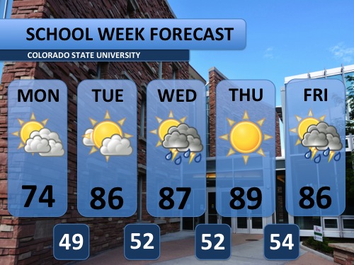
WEEK AHEAD: Remember the cool, dreary weather from late last week? It was certainly unseasonably cool for mid-September! This coming week will have its share of unseasonable weather too, but it will be more on the warm side of the scale. A strong area of warmer, drier air will set up over Colorado and the southwestern United States through most of the week. Interestingly enough, last Thursday (Sept. 11) temperatures dove towards record lows. This Thursday (Sept. 18) will reach toward the record high. Swap the umbrella and rain jacket for a pair of shorts and some sunglasses! Although there is a weak thunderstorm in the forecast for Wednesday, the odds of getting any significant amount of rain won’t come until Friday and the weekend. Saturday and Sunday also look to be a bit cooler at this point.
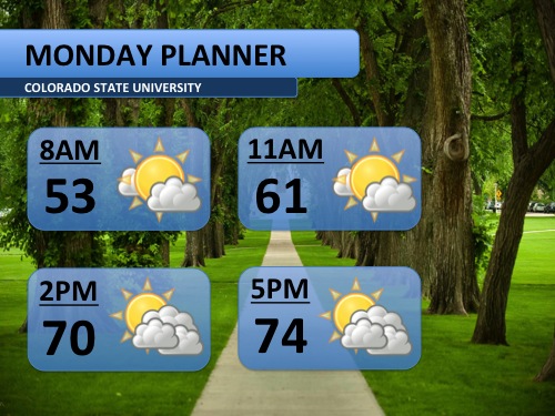
TODAY’S FORECAST: A sunny start to your Monday morning will give way to some additional clouds after the lunch hour, but partly sunny conditions will prevail for most of the day. Any storms that do develop Monday afternoon will stay to the west of the Front Range, leaving Fort Collins dry. Monday is the coolest day in the forecast, so enjoy it while you can! High temperatures won’t cool back down to the seventies until Saturday.