

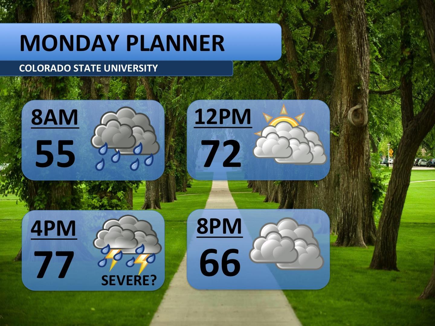
Temperatures into the 90s last week gave way to a somewhat cooler, more comfortable weekend. Monday will continue with this milder trend. Morning showers and cloudy skies will greet those heading out for an early workout or 8:00a.m. class. The rain should taper off between about 10:00a.m. and 2:00p.m.
Towards the mid-afternoon, widespread showers and storms are expected to develop across the Front Range. Although late in the year, any afternoon storms Monday could become strong — hail and high winds are the main threat. Behind these storms, temperatures will fall into the 60s and stay there for the evening hours. Clouds are forecast to hang on through the evening as well.
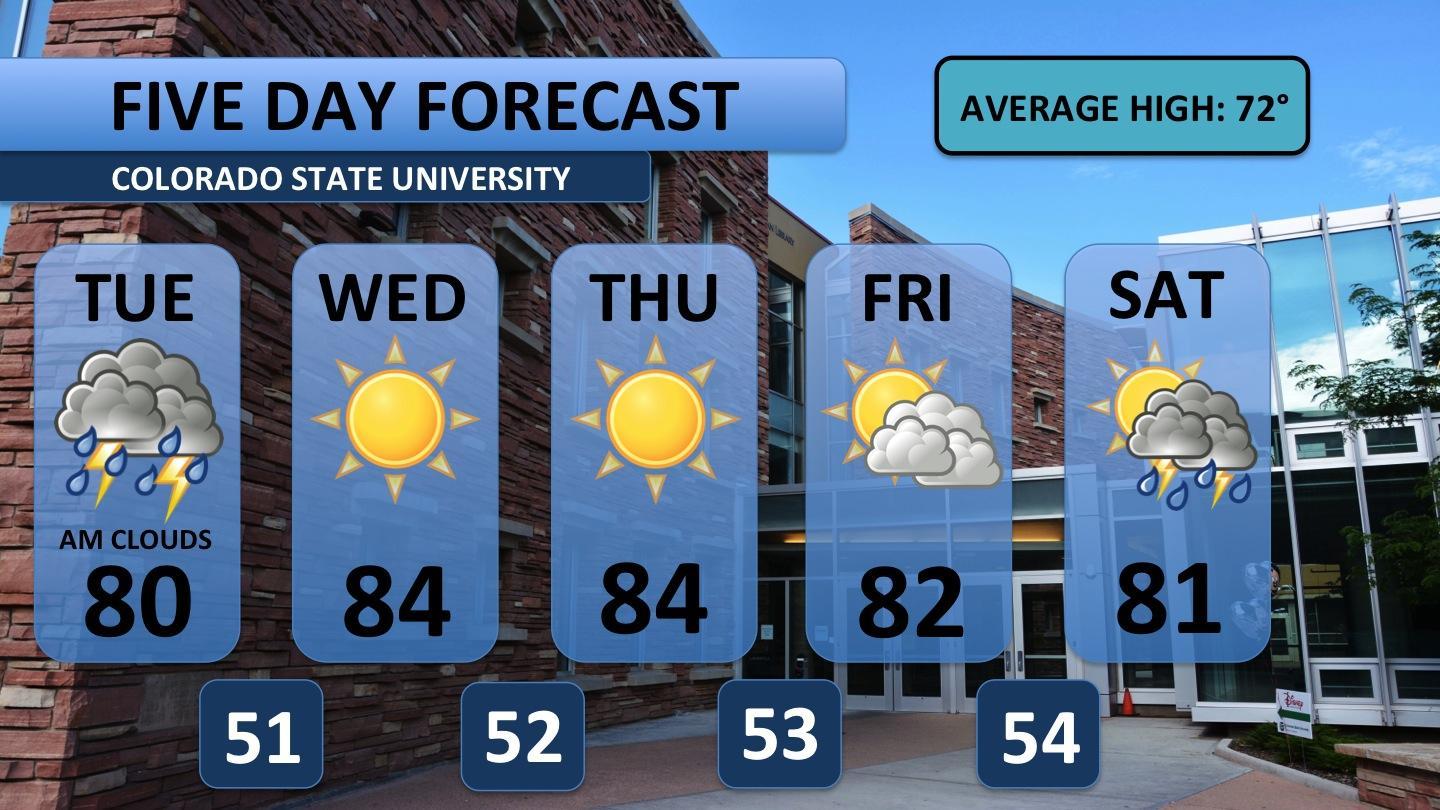
Although Monday is pegged to be cloudy and stormy, the rest of the week is a different ballgame. Tuesday and Wednesday will reminisce on last week’s hot weather. The next six days will feature temperatures of at least ten degrees above average.
Tuesday morning will look much like Monday — cooler and cloudy. The afternoon, though, should feature more sun and a few small, non-severe storms.
Wednesday and Thursday are twin days. Expect lots of sun all through the day and night. Most of the afternoon of those days will be in the 80s.
Friday, moisture starts making a return to the area. Storms are possible to the west, in the foothills, but look unlikely for Fort Collins. Partly cloudy skies return to the area. Saturday marks the reappearance of precipitation to the area; however, forecasts are leaning towards the typical weak afternoon thunderstorm.
The next major rain event looks to hold off until early next week. More seasonable temperatures would come with that moisture. I’ll have more on that later in the week.
Happy Monday! Go rams!
Blogger Austin Harley can be reached at Blogs@collegian.com.


