

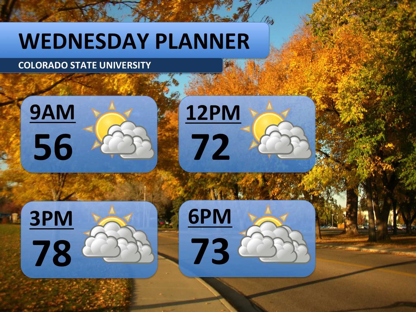
Wednesday will feel a lot like Tuesday, but it will look a little bit different. Although it will be much warmer than normal again, clouds will slowly fill into the area throughout the day. These high clouds won’t have much of an effect on the temperatures nor will they bring rain. Thursday, though, is a whole different story.
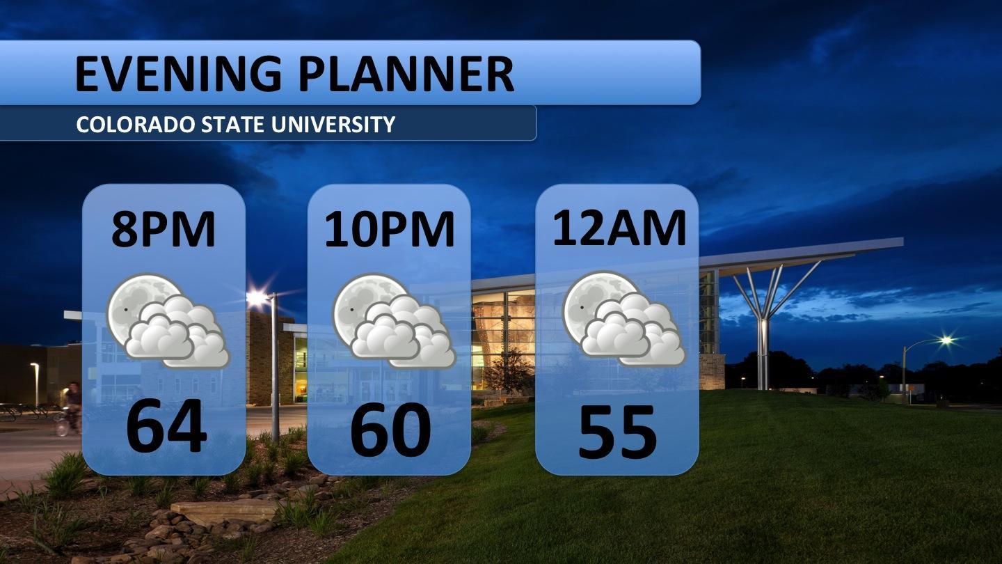
Clouds will stick around into Wednesday evening. It should still be in the 60s through 10:00 p.m. Enjoy the warmer nighttime weather because it’s about to come to an end.
As we have progressed through the week, the moisture from Tropical Storm Simon has continued to make its way toward Colorado. The most recent forecasts have sped up the timing of the system just a bit. Major rainfall now looks more likely during the daylight hours of Thursday, which would hold temperatures to the 50s. Showers are expected to continue through the night and into Friday. In total, about an inch or more of rain is forecasted. Overcast skies, chilly temperatures and occaisional showers will stick around Friday. By the late afternoon and evening, rainfall should let up, but a pretty cool night is in store.
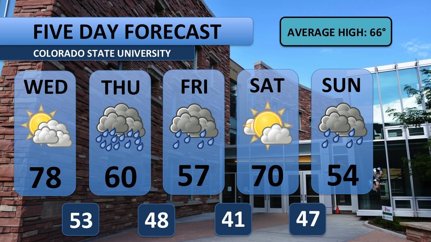
Saturday is expected to rebound back into the 70s, and you’ll want to get your outdoor activities done that day! Sunday marks round two of the rain. A cold front is forecast to push through from the north, possibly bringing another full day of rain to the area.


